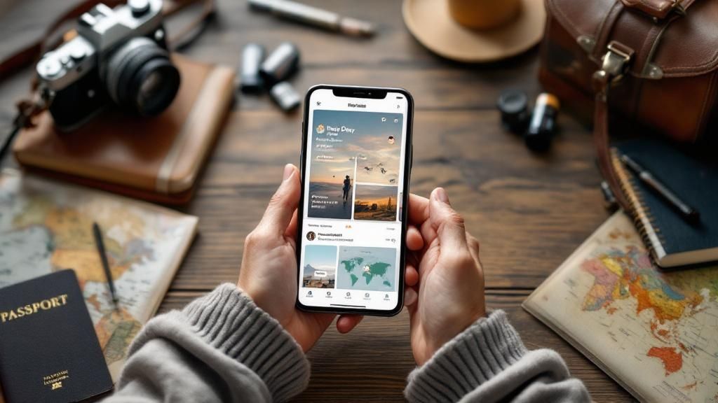
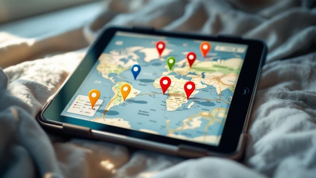
The best souvenir isn’t something you can buy—it’s the map of memories you create along the way. A well-crafted traveller map turns scattered moments into a clear, visual story of where you’ve been and what you’ve experienced. If you’re looking to map your travels with minimal effort and maximum impact, Acti for iOS offers a smart, automatic way to build a timeline of visited places enriched by photos and comments.
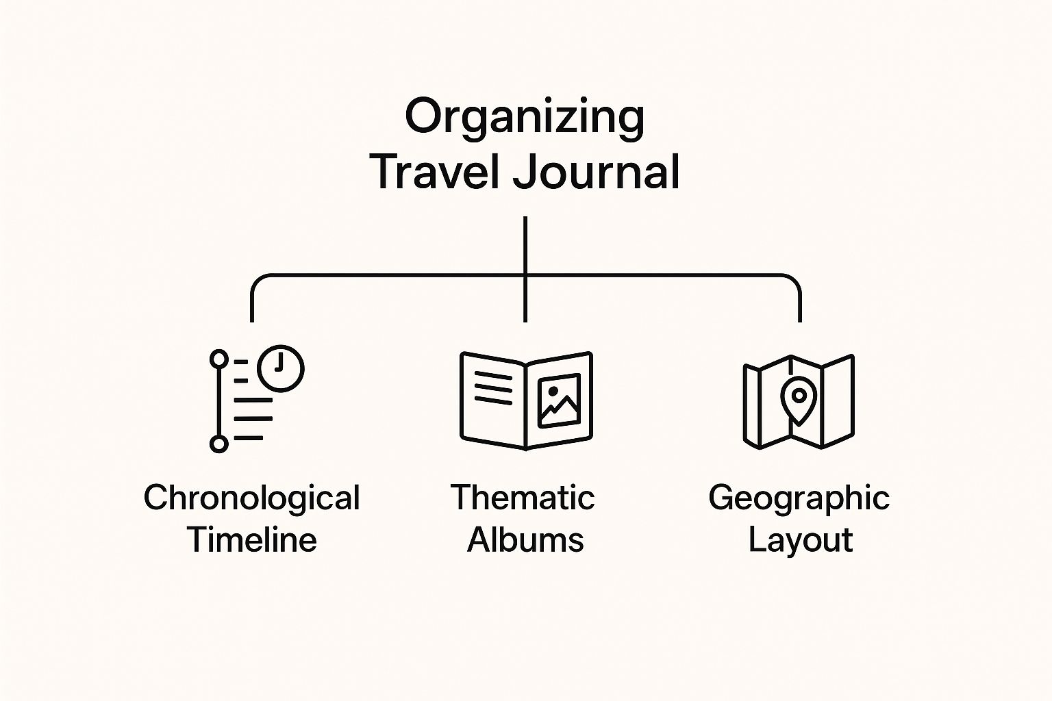
What Is a Traveller Map—and Why It Matters
A traveller map is more than pins on a screen. It’s a dynamic record of your journeys: the cities you explored, the coffee shops you loved, the hikes that took your breath away. Done right, it captures context—the who, what, when, and why behind each stop—so your past trips stay vivid and useful for future planning.
With a modern travel tracker, your traveller map becomes a living document. Instead of manually logging every stop, you can focus on savoring the experience while your app quietly notes places you visited. Later, you layer in photos and reflections, transforming raw location history into a polished travel journal.
Key Benefits of a Digital Traveller Map
Why invest in a traveller map? Because it elevates every stage of travel:
Memory and meaning: Anchor memories to real places and moments, making trips easier to recall and share.
Planning and discovery: Spot patterns in your travels—neighborhoods you frequent, distances you prefer—to plan smarter next time.
Storytelling: Share a coherent trip narrative rather than an unorganized photo dump.
Personal growth: See how your interests evolve over time—from museums to mountains to street food.
Meet Acti: Your Smart Traveller Map and Life Journal on iOS
Automatic place capture: Acti quietly tracks where you go and organizes stops into a timeline.
Photo integration: Attach images to specific places, so each pin tells a visual story.
Context-rich notes: Add comments to remember flavors, feelings, and details that photos can’t capture alone.
Whether you’re documenting a weekend city break or mapping a months-long journey, Acti keeps your traveller map accurate, organized, and personal.
How to Build a Meaningful Traveller Map with Acti
Use these practical steps to turn your trips into a high-quality map you’ll revisit for years.
Before you go: set yourself up for success
Install Acti on your iPhone and grant location permission so it can automatically build your visited-places timeline.
Decide what you want to capture: food highlights, scenic views, cultural sites, or practical tips (transport, costs, timing).
Create a simple note template you’ll reuse in comments (try: “What stood out, One tip, Would I return?”).
On the move: capture context while it’s fresh
After each significant stop, open Acti to review your timeline and add a quick comment—aim for 1–3 sentences.
Attach 2–4 photos per place. Choose one “hero” image and a couple of detail shots (menu, sign, view).
Name places in a way your future self will understand: “Sunrise at Mirador San Nicolás” beats “viewpoint.”
After the day: tidy and enrich
In the evening, skim your timeline. Merge near-duplicate stops (if applicable), correct names, and fill gaps with brief notes.
Write a 3-line daily summary in a comment: today’s highlight, a practical tip, and one thing you’d do differently.
After the trip: turn data into a story
Review your full Acti timeline to spot patterns—best neighborhoods, ideal trip length, or favorite experiences.
Tag standout places in your comments with keywords like “coffee,” “hike,” or “sunset” to make future searches easier.
Share select screenshots of your map and timeline with friends seeking recommendations.
Pro tips for better travel tracking
Write evocative comments: “Smoky, citrusy espresso” is more useful than “good coffee.”
Time-stamp your notes (“Arrived 7:15 a.m.—no line”) to help future planning.
Balance breadth and depth: capture every major stop, but go deep on the top 3–5 highlights each day.
Practical Examples: Traveller Map Use Cases
Weekend city break: Land Friday night, open Acti after check-in to mark your base. Add comments at each café or museum. By Sunday, you have a clean timeline to share—perfect for quick recommendations.
Road trip: Each fuel stop, scenic overlook, and diner becomes a pin with photos and notes. Later, your Acti timeline helps you calculate ideal drive times and identify your favorite stretches.
Long-term travel: Over weeks or months, Acti’s automatic tracking preserves continuity. Short comments prevent memory drift, and your traveller map evolves into a comprehensive, personal travel history.
SEO-Friendly Best Practices for Your Traveller Map
Use consistent phrasing (e.g., “traveller map,” “travel tracker,” “timeline of visited places”) in your comments to enhance searchability.
Describe locations with clear, unique names to distinguish similar stops.
Add practical keywords to comments—“budget lunch,” “kid-friendly,” “sunset viewpoint”—so you can quickly filter ideas later.
Ready to map your travels with intention and ease? Acti on iOS makes building a traveller map simple: it tracks your visited places automatically and lets you enrich each stop with photos and comments, turning your trips into a living, searchable story. Install Acti, start your next journey, and watch your travel timeline come alive.
Everyone loves to ask, “Where have u been?” Whether it’s a friend catching up after a busy month or a colleague curious about your latest trip, the answer is often scattered across photos, receipts, and fading memories. Imagine having a clear, beautiful timeline of your visited places—complete with photos and comments—ready whenever you want to remember, share, or reflect. That’s exactly what Acti delivers: an iOS travel tracker and life journal that automatically builds your story of places.
Why “Where Have U Been” Matters More Than You Think
Places are the anchors of our memories. The café where you closed a deal, the park where your kid took their first bike ride, the beach you stumbled upon at sunset—each spot holds meaning. A simple location history becomes powerful when it’s connected to context: what you did there, how it felt, and what you want to remember later. “Where have u been” isn’t just a question about geography; it’s a question about your life.
Yet most of us rely on manual notes or loosely organized photos to reconstruct our days. This creates friction and gaps. A more natural way is to let your phone do the heavy lifting—then you add the color through photos and comments. That’s the promise of Acti.
Meet Acti: Your Automatic Travel Tracker and Life Journal
Acti is an iOS app that automatically builds a timeline of the places you visit and enriches them with your photos and comments. Instead of manually checking in or writing lengthy entries, you get an effortless, chronological record of your journeys—from daily routines to once-in-a-lifetime trips. When someone asks, “Where have u been?” you can scroll through a living map of your life, each stop brought to life with images and notes.
Key benefits include:
Automatic timeline of visited places, so you never miss a moment
Photos and comments attached to each place for vivid, personal context
A clear, organized travel journal you can revisit anytime
How It Works in Real Life: Practical Examples
Acti fits seamlessly into your day. Here’s what it looks like in action:
Commute and coffee: You stop at your favorite café on the way to work. Acti logs the visit automatically. While you sip, you add a quick comment: “Tried the new seasonal blend—loved it.” Snap a photo of the latte art, and your morning is saved as a small, delightful memory.
Weekend getaway: You drive to a coastal town, visit a lighthouse, explore a local market, and end the day at a seafood spot. Acti captures your stops as a timeline. You attach photos of the lighthouse view and add a note about the hidden bakery stall that sold the best croissants.
Business trip: Between meetings, you discover a great lunch spot and a quiet park. Add a comment like, “Perfect place to prep for the afternoon session,” and a photo of your favorite dish. Later, when planning a return visit, your personal recommendations are at your fingertips.
This simple loop—automatic place logging plus quick, personal enrichment—turns scattered experiences into a cohesive, searchable story.
Actionable Tips to Get the Most from Acti
Start with the essentials: After installing Acti on your iPhone, open the app and follow the prompts to enable location access. This ensures your timeline of visited places is captured automatically.
Add context while it’s fresh: After a stop, spend 30 seconds adding a comment. Note who you were with, what you did, and why it mattered. These details make the memory far more valuable later.
Let photos do the storytelling: Attach one or two meaningful images. A single, well-composed photo per place beats a large, uncurated gallery.
Use consistent phrasing: In your comments, repeat helpful cues like “workout,” “client meeting,” or “date night.” This makes future browsing more intuitive.
Review weekly: Set aside five minutes on Sunday to scroll through your week. Add any missing notes and mark standout places you want to revisit.
Create thematic highlights: As you review, jot down short highlights like “Top three coffee shops this month” or “Best sunset spots.” These mini-summaries make sharing recommendations quick and fun.
Mind your settings: If you ever need to adjust location permissions, you can do so in your iOS settings. Choose the level of access that matches your needs.
Who Benefits Most: From Travelers to Everyday Explorers
Acti is perfect for avid travelers, but it’s just as helpful for everyday life:
Travelers: Keep a tidy log of every city and attraction, enriched with photos and comments that capture each day’s highlights.
Foodies: Remember exactly where you tried that incredible ramen, plus your notes on what to order next time.
Professionals: Track client visits and conference days, adding quick context that helps with follow-ups and trip reports.
Families: Chronicle parks, museums, and weekend adventures so you can relive milestones and plan repeat visits.
Students: Record study spots, campus resources, and local discoveries for a personal guide to your city.
In each case, the combination of an automatic timeline with photos and comments transforms “where have u been” from a vague recollection into a trustworthy, vivid record.
Why This Approach Works
Consistency and low friction are the secret. Manual journals often fail because they demand too much effort in the moment. Acti captures the where automatically, and you add the why with quick notes and photos. That balance keeps your habit sustainable and your memories rich—without turning journaling into a chore.
Start Your Timeline Today
The next time someone asks, “Where have u been?”, imagine scrolling through a clear, beautiful timeline that answers the question instantly.
Install Acti on your iPhone, enable location access, and let your travel tracker start building your life journal in the background. Add a few photos and comments along the way, and watch your history come alive—one place at a time.
Ready to remember more and forget less? Open Acti, take your first step outside, and let your story write itself.
How often do you pause and ask yourself, “Where have you been going?” Between commutes, coffee stops, client visits, weekend hikes, and big trips abroad, your days are filled with movement—and meaning. The challenge is remembering it all.
Acti, a travel tracker and life journal for iOS, automatically builds a timeline of your visited places and lets you enrich each stop with photos and comments. It’s a simple, elegant way to turn your life’s motion into a story you can revisit, search, and share.
Why Tracking “Where Have You Been Going” Matters
Location is a powerful thread that weaves your memories together. Mapping where you’ve been helps you:
Remember more, with less effort: Context matters. Seeing a place name jogs recall of conversations, meals, weather, and feelings you’d otherwise forget.
Spot patterns and habits: Discover how often you visit certain neighborhoods, how far you walk on weekends, or which cafés fuel your best work.
Plan smarter: Use your past movement to estimate travel times, pick efficient routes, and create realistic itineraries for upcoming trips.
Tell richer stories: Whether you’re sharing a yearly recap or documenting a once-in-a-lifetime journey, a place-based timeline adds structure and detail.
In short, a reliable “where have you been going” log becomes both a memory aid and a planning tool—one that grows more valuable with every day you use it.
Meet Acti: Your Automatic Timeline of Visited Places
Acti is an iOS travel tracker and life journal designed to answer the question “Where have you been going?” without constant manual effort. As you move through your day, Acti automatically builds a clean, chronological timeline of the places you visit. For each stop, you can add photos from your camera roll and jot quick comments—turning a simple list of locations into a meaningful narrative.
Key advantages of using Acti as your iOS travel journal:
Effortless capture: No need to check in or type addresses. Acti captures the essentials automatically, so you can stay present.
Context-rich memories: Attach photos and short notes to each place to preserve the “feel” of the moment—what you saw, tasted, or learned.
Clean, visual timeline: Review your day, week, or trip at a glance. A clear history means less scrolling and more insight.
Flexible journaling: Add quick thoughts on the go, then expand later when you have time to reflect.
The result is a living log of your life—part travel tracker, part life journal—that keeps your experiences organized and easy to revisit whenever you want.
Practical Examples: Everyday and Travel Use Cases
Acti isn’t just for big trips. It shines in everyday life as well as on the road. Here are real-world ways to put it to work:
Daily routine insights: See how often you visit the gym, which grocery store you frequent, or how your commute changes over time. Note energy levels or productivity after certain stops.
Client and project tracking: Consultants and freelancers can quickly reference site visits, meeting locations, and dates—useful for invoicing or reporting.
Restaurant and café log: Save photos of meals, jot down ratings, and remember what to order next time. Your timeline becomes a personal city guide.
Weekend exploration: Document neighborhood walks, museums, and parks with a few photos and comments to build a catalog of local discoveries.
Travel journaling: On trips, Acti automatically outlines your itinerary—airports, hotels, landmarks—while you add snapshots and notes, creating a shareable trip log without the headache.
Family memories: Capture first visits with kids, seasonal traditions, and holiday outings with context that future-you will cherish.
Actionable Tips to Get More from Acti
Turn Acti into your most useful “where have you been going” tool with these simple practices:
Set a 2-minute daily recap: Each evening, scan your timeline and add one photo or one sentence to places that mattered. This tiny habit compounds into a rich journal.
Use consistent tags in comments: Add simple tags like “#workout,” “#client,” or “#date-night” to make your notes easier to scan later.
Anchor memories with sensory detail: In your comment, include one sensory cue (e.g., “citrus aroma,” “street violinist,” “rain on the roof”). These cues turbocharge recall.
Highlight wins and lessons: Add a quick “win” or “lesson” after meetings, events, or hikes. Over time, this becomes a searchable knowledge base of your life.
Add photos that tell the story: Instead of posting every shot, pick 1–3 images that capture context—entrance signs, menus, ticket stubs, or wide shots of the setting.
Review weekly: Do a Sunday review of your visited places. Mark favorites, tidy comments, and note patterns to inform the week ahead.
Mind privacy and control: Choose the location permissions you’re comfortable with in iOS Settings, and pause location access anytime you want a break from tracking.
These habits keep your timeline clean, insightful, and genuinely useful for both memory and planning.
Start Your Timeline Today with Acti
If you’ve ever struggled to answer “Where have you been going?” beyond a few highlights, Acti is your missing piece. It quietly captures the places you visit, then lets you bring them to life with photos and comments—no tedious logging, no fragmented notes. Over days and weeks, that effortless record becomes a powerful personal archive: a travel tracker when you’re on the move, a life journal when you’re at home, and a clear timeline of visited places whenever you want to look back.
Begin today: install Acti on your iPhone, take a short walk, add a photo and a sentence to one stop, and see how quickly the story of your life takes shape. Your future self will thank you for the clarity, the memories, and the perspective that only a well-kept timeline can provide.
In a world where adventure awaits at every corner, keeping track of your travels has never been more exciting or accessible. As we step into 2025, the landscape of travel has transformed, offering numerous innovative travel tracker apps designed to elevate your journeys. Whether you’re exploring hidden gems in a bustling city or embarking on a scenic road trip, having the right tools at your fingertips can enhance your experience. From mapping your routes and managing expenses to sharing unforgettable moments with friends and family, these apps are essential companions for every traveler. Join us as we unveil best travel tracker apps that promise to streamline your adventures and ensure you make the most of every moment on the road. Get ready to elevate your wanderlust and transform the way you explore the world this year!
Importance of Travel Tracker Apps for Modern Travelers
In today’s fast-paced world, where technology seamlessly integrates into our daily lives, travel tracker apps have become indispensable tools for modern travelers. These apps serve as virtual travel companions, offering a wealth of features that simplify and enhance the travel experience. Whether you’re a solo adventurer or traveling with a group, having a reliable app to document your journey, manage logistics, and ensure safety can make a significant difference. With the ability to track routes, monitor expenses, and share experiences in real-time, travel tracker apps cater to the needs of contemporary explorers who seek convenience and efficiency on the road.
The importance of these apps extends beyond mere convenience. For many travelers, documenting their journeys is a way to preserve memories and share experiences with loved ones. Travel tracker apps provide a platform to capture moments through photos, videos, and written anecdotes, creating a comprehensive travel diary that can be revisited long after the trip is over. Moreover, these apps often include social features that allow users to connect with fellow travelers, exchange tips, and discover new destinations, fostering a sense of community among wanderlust-driven individuals.
Safety is another crucial aspect where travel tracker apps prove their worth. Many apps come equipped with features such as location sharing, emergency contacts, and real-time alerts, ensuring that travelers can stay connected and informed regardless of their whereabouts. This added layer of security offers peace of mind to both travelers and their loved ones, making it easier to venture into unfamiliar territories with confidence. In essence, travel tracker apps are not just tools; they are gateways to a more organized, enjoyable, and secure travel experience.
Key Features to Look for in Travel Tracker Apps
When choosing a travel tracker app, it’s essential to consider the features that align with your travel needs and preferences. One of the primary features to look for is route mapping and navigation. A good travel tracker app should offer detailed maps, GPS functionality, and the ability to plan and save routes. This ensures that you can easily navigate through unfamiliar areas and keep track of the places you’ve visited. Additionally, look for apps that provide offline maps, as this can be incredibly useful in areas with limited internet connectivity.
Expense tracking is another vital feature to consider. Traveling often involves managing a budget, and having an app that helps you keep track of your expenses can prevent overspending and financial stress. Look for apps that allow you to categorize your expenses, set budgets, and generate reports. This will give you a clear overview of your spending habits and help you make informed financial decisions during your trip. Some apps even offer currency conversion tools, which can be a lifesaver when traveling internationally.
Social sharing and connectivity features are also worth considering. Many travel tracker apps offer options to share your journey with friends and family through social media integration or in-app sharing. This allows you to keep your loved ones updated on your adventures and receive real-time feedback and recommendations. Additionally, some apps offer community features where you can connect with other travelers, join groups, and participate in discussions. These social elements can enhance your travel experience by providing valuable insights and fostering a sense of connection with fellow explorers.
Overview of the Top 5 Travel Tracker Apps
As we delve into the top travel tracker apps of 2025, you’ll find a diverse range of options catering to different travel styles and preferences. These apps have been selected based on their features, user reviews, and overall performance. Each app offers unique functionalities that can elevate your travel experience, whether you’re a frequent flyer, a road trip enthusiast, or an adventure seeker. Let’s take a closer look at the top 5 travel tracker apps that are set to revolutionize your journeys this year.
Acti: the ultimate app for recording and reliving your favorite experiences. With Acti, you can effortlessly keep track of your visits to places you already know and love. Capture memories by adding photos, leaving comments, tracking activities, and rating your experiences. Acti is not just a memory preservation tool; it’s a personal digital diary that combines both the extraordinary moments and everyday routines into one secure place.
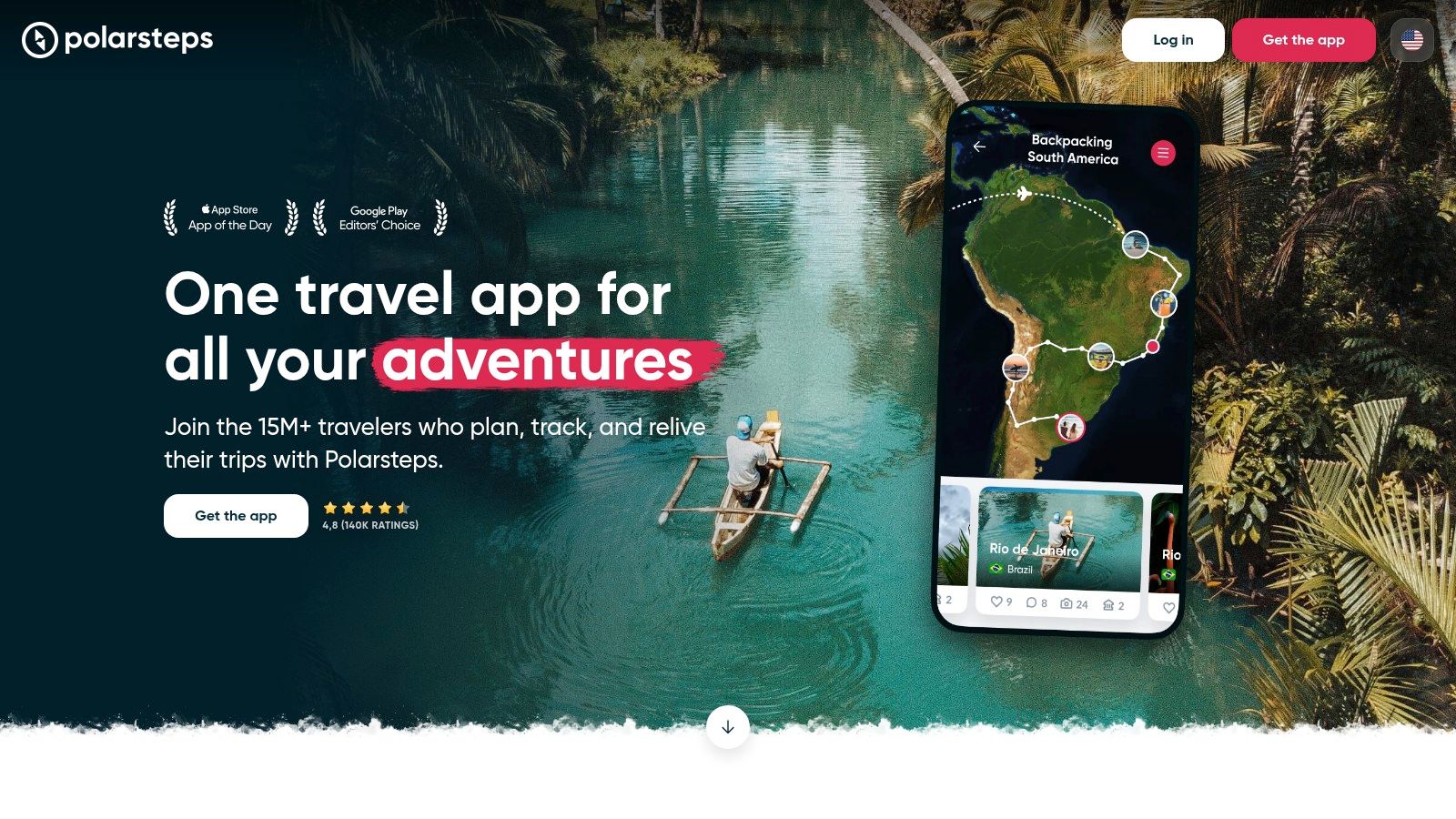
Polarsteps: This app is perfect for documenting your travels through photos, videos, and notes. Polarsteps automatically tracks your route and allows you to create a visual travel diary that can be shared with friends and family. Its offline capabilities make it ideal for remote adventures.
Roadtrippers: Tailored for road trip enthusiasts, Roadtrippers helps you discover interesting stops, scenic routes, and hidden gems along your journey. The app’s extensive database of attractions and user reviews ensures you have a memorable road trip experience.
TravelBank: Designed for business travelers, TravelBank offers expense tracking, budgeting, and travel rewards. Its integration with corporate travel policies and expense management systems makes it a valuable tool for managing work-related travel.
Been: If you love keeping track of the places you’ve visited, Been is the app for you. It allows you to mark countries and cities on a map, giving you a visual representation of your travel history. This app is perfect for those who enjoy setting travel goals and tracking their progress.
No registration – Start using immediately without accounts
Visual mapping – See all your visits on an interactive map
Cons:
One downside of Acti is that some of its advanced features are only available with a paid subscription.
Polarsteps
Pros:
Polarsteps is perfect for those who love to document their travels visually. The app automatically tracks your route and allows you to create a beautiful travel diary with photos, videos, and notes. Its offline capabilities make it ideal for remote adventures where internet access is limited.
Cons:
One limitation of Polarsteps is that it can drain your phone’s battery quickly due to continuous GPS tracking. Additionally, while the app is excellent for documenting personal journeys, it lacks some of the itinerary management features found in other travel tracker apps.
Roadtrippers
Pros:
Roadtrippers is a must-have for road trip enthusiasts, offering extensive information on interesting stops, scenic routes, and hidden gems. Its user-generated reviews and recommendations ensure you have a memorable road trip experience. The app also allows for easy route planning and customization.
Cons:
A drawback of Roadtrippers is that its free version has limited functionality, and some of the more advanced features require a paid subscription. Additionally, the app’s extensive database can sometimes lead to information overload, making it challenging to choose the best stops.
TravelBank
Pros:
TravelBank is designed with business travelers in mind, offering efficient expense tracking, budgeting, and travel rewards. Its integration with corporate travel policies and expense management systems makes it a valuable tool for managing work-related travel. The app also provides travel insights to help you make informed decisions.
Cons:
One downside of TravelBank is that it may not be as useful for leisure travelers who do not require extensive expense management features. Additionally, the app’s focus on business travel means it lacks some of the social and documentation features found in other travel tracker apps.
Been
Pros:
Been is perfect for travelers who enjoy keeping track of the places they’ve visited. The app allows you to mark countries and cities on a map, giving you a visual representation of your travel history. It’s a great tool for setting travel goals and tracking your progress over time.
Cons:
One limitation of Been is that it is primarily focused on tracking visited locations and does not offer many additional features such as route planning or expense tracking. Additionally, the app’s simplistic design may not appeal to users looking for a more comprehensive travel tracker.
How to Choose the Right Travel Tracker App for You
Selecting the right travel tracker app depends on your specific travel needs and preferences. Start by identifying the primary features that are most important to you. If you prioritize itinerary management and real-time alerts, apps like TripIt or TripCase might be the best fit. For those who enjoy documenting their journeys visually, Polarsteps or Journi could be ideal choices. Consider whether you need advanced mapping capabilities, expense tracking, or social sharing features, and choose an app that excels in those areas.
It’s also essential to consider the type of travel you typically engage in. Business travelers may benefit from apps like TravelBank, which offer robust expense management and integration with corporate travel policies. In contrast, road trip enthusiasts might find Roadtrippers more useful due to its extensive database of interesting stops and scenic routes. If you often travel with a group, an app like Wanderlog that offers collaborative planning features could enhance your travel experience.
Finally, take into account user reviews and ratings to gauge the overall performance and reliability of the app. Look for feedback on ease of use, customer support, and any potential issues that users have encountered. Many travel tracker apps offer free versions or trial periods, so take advantage of these options to test the app’s functionality before committing to a paid subscription. By carefully considering your needs and preferences, you can choose a travel tracker app that truly elevates your adventures.
Tips for Maximizing Your Travel Experience with Tracker Apps
To make the most of your travel tracker app, start by familiarizing yourself with its features and functionalities. Spend some time exploring the app’s interface and settings to understand how it works. Many apps offer tutorials or help sections that can provide valuable insights into using the app effectively. The more you know about the app’s capabilities, the better you can leverage its features to enhance your travel experience.
One of the best ways to maximize the benefits of your travel tracker app is to use it consistently. Regularly update your itinerary, log expenses, and document your journey through photos and notes. This not only helps you stay organized but also creates a comprehensive record of your trip that you can look back on. Consistent use of the app also ensures that you receive real-time alerts and updates, keeping you informed and prepared throughout your journey.
Don’t forget to take advantage of the social and community features offered by many travel tracker apps. Share your experiences with friends and family, connect with fellow travelers, and participate in discussions and forums. These interactions can provide valuable tips and recommendations, as well as foster a sense of connection with other travelers. Additionally, consider integrating your travel tracker app with other travel tools and services you use, such as booking platforms, navigation apps, and expense management systems, to create a seamless travel experience.
User Testimonials: Real Experiences with Travel Tracker Apps
User testimonials provide valuable insights into the practical benefits and potential drawbacks of travel tracker apps. Many travelers have shared their experiences, highlighting how these apps have enhanced their journeys. For instance, Anna, an avid solo traveler, praises TripIt for its comprehensive itinerary management and real-time alerts. She mentions that the app has saved her on multiple occasions by notifying her of flight delays and gate changes, allowing her to make timely adjustments to her plans.
James, a business traveler, finds TravelBank indispensable for managing his work-related travel expenses. He appreciates the app’s seamless integration with his company’s expense management system and the ability to track his spending in real-time. According to James, TravelBank has not only helped him stay within budget but also made the reimbursement process more efficient and hassle-free.
Emily, who loves documenting her travel adventures, is a fan of Polarsteps. She enjoys creating visual travel diaries with photos, videos, and notes, and finds the app’s offline capabilities particularly useful during remote trips. Emily also appreciates the social sharing features, which allow her to keep her friends and family updated on her journey. Her testimonial highlights how Polarsteps has become an essential part of her travel routine, helping her preserve precious memories.
Future Trends in Travel Tracking Technology
The future of travel tracking technology promises exciting advancements that will further enhance the travel experience. One emerging trend is the integration of augmented reality (AR) into travel tracker apps. AR can provide immersive and interactive travel experiences, such as virtual guided tours, real-time navigation overlays, and detailed information about landmarks and attractions. This technology has the potential to revolutionize the way travelers explore and interact with their surroundings.
Another trend to watch is the increasing use of artificial intelligence (AI) and machine learning in travel tracker apps. AI-driven recommendations and personalized travel plans can help travelers discover new destinations, optimize their itineraries, and make informed decisions based on their preferences and past behavior. Additionally, AI can enhance safety features by providing real-time alerts and predictive insights about potential risks and hazards.
Sustainability is also becoming a key focus in the development of travel tracking technology. Future apps are likely to incorporate features that promote eco-friendly travel practices, such as carbon footprint tracking, sustainable travel tips, and recommendations for environmentally conscious accommodations and activities. By encouraging responsible travel, these apps can contribute to the preservation of natural and cultural heritage while providing travelers with meaningful and impactful experiences.
Conclusion: Elevate Your Adventures with the Right App
In conclusion, travel tracker apps are powerful tools that can significantly enhance your travel experience in 2023. By offering features such as itinerary management, expense tracking, route mapping, and social sharing, these apps cater to the diverse needs of modern travelers. Whether you’re embarking on a solo adventure, a business trip, or a group journey, the right travel tracker app can help you stay organized, informed, and connected.
As we’ve explored, each of the top 5 travel tracker apps offers unique functionalities that can elevate your adventures. From TripIt’s comprehensive itinerary management to Polarsteps’ visual travel documentation, there’s an app for every type of traveler. By carefully considering your needs and preferences, you can choose the app that best aligns with your travel style and goals.
Embrace the power of technology to transform the way you explore the world. With the right travel tracker app by your side, you can document your journey, manage logistics, ensure safety, and share unforgettable moments with loved ones. Get ready to elevate your wanderlust and make the most of every moment on the road in 2025!
Unlocking Your Travel Memories: A Deep Dive into ‘Places I Visited’ Apps
Ever wished you could effortlessly recall every cafe, museum, or mountain peak you’ve conquered? “Places I visited” apps offer a digital breadcrumb trail, transforming fleeting travel moments into lasting memories. This roundup explores seven diverse options, from established platforms like Swarm and Google Maps Timeline to innovative newcomers like Polarsteps and Visited. We’ll cover pros, cons, pricing, and privacy considerations for each “places I visited” app. Find the perfect app to chart your explorations!
Acti is not just another location history app; it’s your personal travel companion and life journal, meticulously designed for the privacy-conscious iOS user.
Imagine effortlessly documenting your adventures, big or small, without the constant worry of draining your battery or compromising your personal data.
Acti achieves this by cleverly utilizing on-device location tracking, eliminating the need for constant GPS pings and background activity that typically deplete battery life. This also means no need to create an account or upload your sensitive location data to a third-party server, giving you complete control over your privacy.
If you’re a frequent traveler, a globetrotter seeking to preserve memories, a privacy-conscious individual, or simply someone who loves to document their life, Acti offers a refreshing approach to capturing and reliving your experiences.
What truly sets Acti apart is its focus on enhancing your memories. Beyond simply plotting your locations, Acti allows you to enrich each entry with photos, comments, and even ratings, transforming a simple list of places into a vibrant tapestry of your journeys. Imagine looking back at a trip to Rome, not just seeing a pin on a map, but also seeing the photo you took of the Trevi Fountain, reading the comment you wrote about that delicious pasta you had, and remembering the 5-star rating you gave to that charming little trattoria.
This rich journaling feature elevates Acti from a mere location history app to a powerful memory keeper. And sharing these enriched memories is a breeze with seamless social media integration, allowing you to easily share your adventures with friends and family.
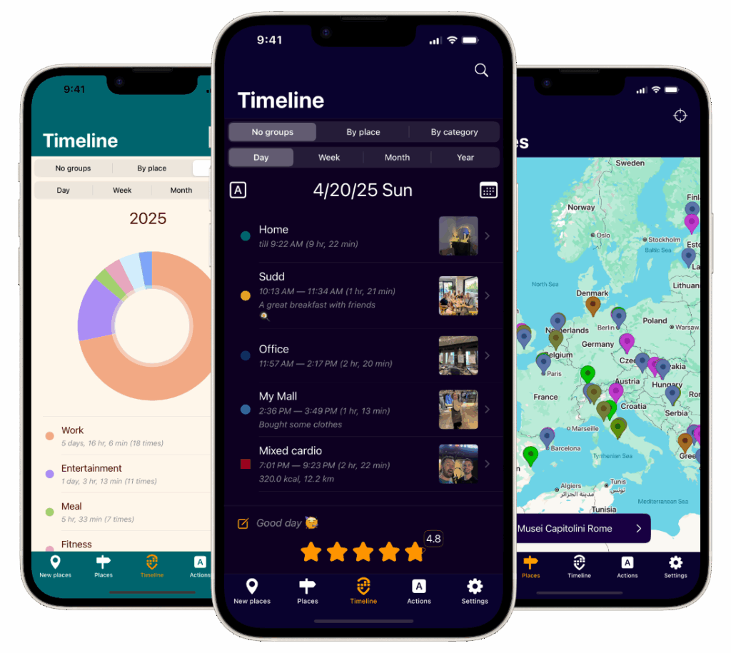
For the analytical traveler, Acti provides customizable timelines, allowing you to explore your adventures day by day, week by week, or even year by year. Its insightful summaries, categorized by location and type of place, offer a fascinating overview of your travel patterns and lifestyle. Ever wondered how much time you’ve actually spent exploring museums versus hiking in national parks? Acti can tell you!
And with just a single tap, you can access the complete history of your visits to any place, transforming scattered travel data into a meaningful and easily navigable narrative of your experiences. This feature is a game-changer for travel bloggers, allowing them to quickly compile information and create compelling content.
Acti’s integration with the iOS Calendar and Health apps, including Apple Watch support, further solidifies its position as a comprehensive lifestyle tool. By connecting your location data with other relevant information, such as your daily step count or calendar events, Acti provides a holistic view of your day-to-day activities. Imagine seeing your hike through Yosemite National Park automatically logged, complete with the photos you took, the distance you covered according to your Apple Watch, and the calendar event reminder you set for the park ranger’s talk. This level of integration creates a powerful and insightful picture of your life.
Want to effortlessly chronicle your journeys without lifting a finger? Google Maps Timeline automatically tracks your location history, creating a comprehensive visual record of your travels and daily movements. It uses your device’s location services to build a detailed map of everywhere you’ve been, making it a fantastic “places I visited app” for the busy traveler. Whether you’re retracing a memorable road trip, analyzing your commute patterns, or simply reminiscing about past adventures, Timeline offers a fascinating glimpse into your personal geography.
For travel bloggers and social media enthusiasts, Timeline offers a quick and easy way to visualize travel routes and share highlights with followers. Business travelers can leverage the data for expense reports and travel planning. Even everyday users will appreciate the ability to rediscover forgotten gems from past explorations. Reviewing your timeline can spark memories and reveal interesting patterns in your daily movements.
Tips for Maximizing Google Maps Timeline:
Regularly review and delete: Maintain control over your data by periodically reviewing and deleting sensitive location information.
Enable photo tagging: Automatically tag your photos with location data for a richer, more immersive travel journal.
Export data: Periodically export your timeline data as a backup or for use in other travel planning tools.
Google Maps Timeline’s effortless location tracking and visual representation of your travel history make it an invaluable tool for any “places I visited” enthusiast. Start exploring your personal world map today!
3. Polarsteps
Want to effortlessly transform your travel adventures into a stunning visual story? Polarsteps is a “places I visited app” that automatically tracks your route and lets you seamlessly add photos and stories, creating a beautiful travel journal without the hassle. It’s perfect for travelers who want to document their journeys with minimal effort while creating shareable content. Whether you’re a backpacker traversing multiple countries, a family creating a vacation memory book, or a digital nomad showcasing your location-independent lifestyle, Polarsteps simplifies the process of building a rich travelogue. Learn more about using Polarsteps to track your travels and create a visual representation of your journey here.
For travel bloggers and social media enthusiasts, Polarsteps offers a visually engaging way to share your adventures and inspire others. Think of it as a dynamic travel diary, automatically populated with location data, photos, and captivating stories, allowing your followers to experience your journey alongside you. Its intuitive interface and automated features make it ideal for even the busiest travelers, allowing them to focus on exploring rather than documenting.
Tips for Maximizing Polarsteps:
Start early: Begin tracking before your trip to capture every moment.
Regular updates: Add photos and stories regularly for a comprehensive journal.
Battery saver: Utilize airplane mode to conserve battery during long travel days.
Photo books: Consider the photo book feature to preserve memories of meaningful trips.
Polarsteps’ unique blend of automated tracking and visual storytelling makes it a fantastic choice for capturing and sharing your travel experiences. Download Polarsteps today and transform your journeys into lasting memories!
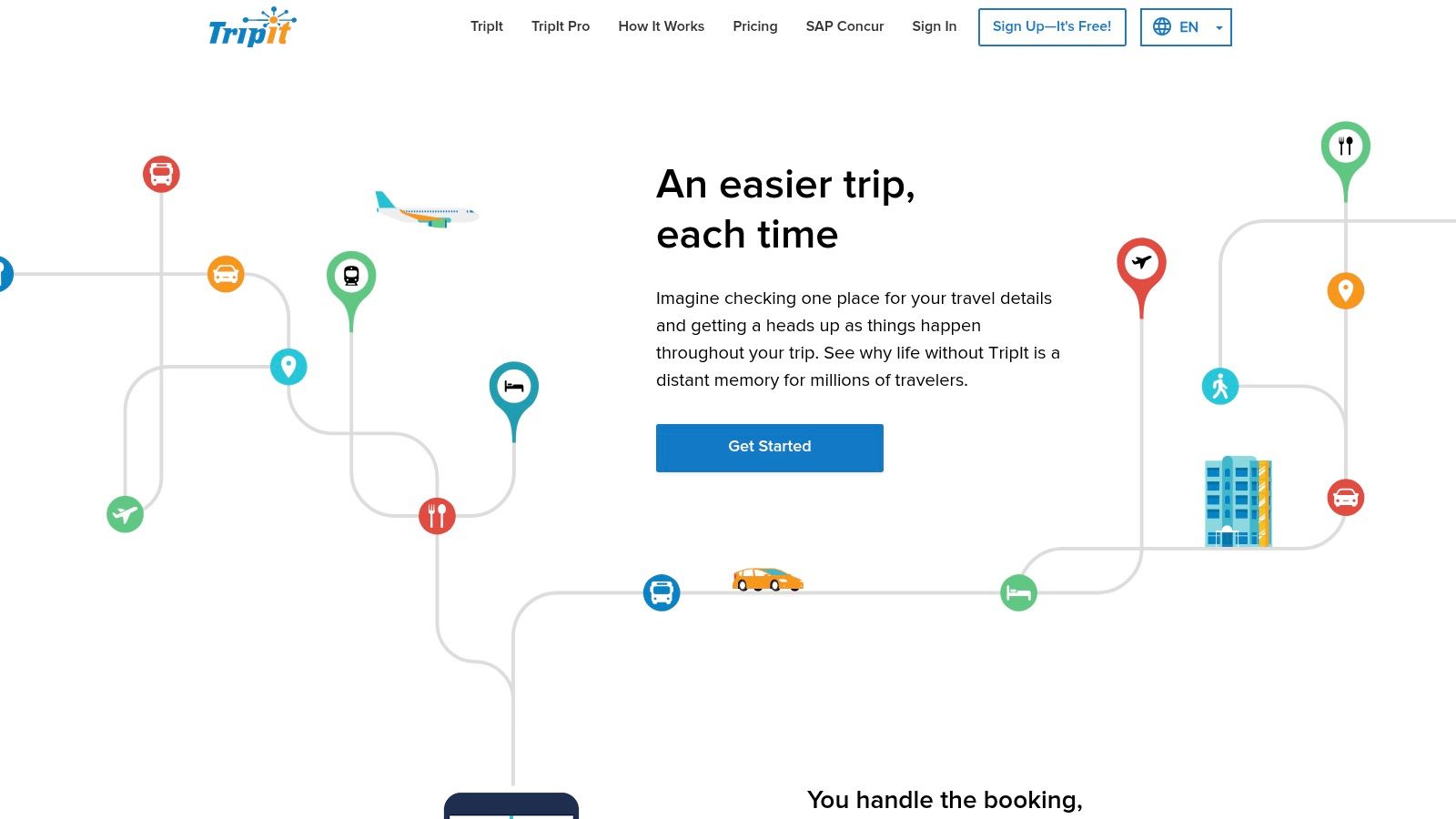
4. TripIt
Transform your overflowing inbox into a meticulously organized travelogue with TripIt! This comprehensive travel organization app automatically generates detailed itineraries simply by forwarding your confirmation emails. While its primary function is itinerary management, TripIt brilliantly doubles as a “places I visited app,” especially for frequent flyers. Whether you’re a business traveler navigating multi-city trips or a vacation planner consolidating bookings, TripIt offers a seamless way to chronicle your journeys. Learn more about TripIt features in our comprehensive guide Learn more about….
TripIt shines for business travelers managing complex itineraries, frequent flyers tracking airline status, and even travel managers organizing corporate travel. Imagine having all your flight details, hotel reservations, and rental car information readily accessible in one place. No more frantic email searches or lost confirmations – TripIt keeps everything organized and at your fingertips.
Tips for Maximizing TripIt:
Forward all confirmations: Send every travel-related email to plans@tripit.com to automatically build your itineraries.
Calendar integration: Connect your calendar for seamless scheduling and avoid conflicts.
Sharing is caring: Share itineraries with family or colleagues for safety and coordination.
Analyze travel trends: Review your annual travel summaries to gain insights into your travel patterns.
TripIt isn’t just about organizing your upcoming trips; it’s about building a valuable record of your past adventures. Its ease of use and comprehensive features make it an essential tool for any serious traveler looking to effortlessly track their journeys. Download TripIt today and transform travel chaos into organized exploration!
5. Visited Countries & Cities
Want to visualize your global adventures and fuel your wanderlust? Visited Countries & Cities is the perfect “places I visited app” for charting your explorations across the globe. Specifically designed for mapping your travels, this app lets you mark off visited countries and cities, offering insightful statistics and an interactive world map showcasing your personal travel footprint. It’s an excellent tool for setting travel goals and celebrating your achievements as you conquer your bucket list. Whether you’re a seasoned globetrotter, a gap year adventurer, or an expat documenting international moves, this app provides a satisfying way to track your journey.
For travel enthusiasts, Visited Countries & Cities offers a visual representation of their global reach, motivating them to explore even more. Sharing your personalized map on social media can inspire others and spark conversations about your experiences. The app’s bucket list feature helps you plan future trips, and the statistical overview provides a fascinating glimpse into your travel patterns. Reviewing your visited locations can rekindle memories and inspire your next adventure.
Tips for Maximizing Visited Countries & Cities:
Be honest about visits: Define what constitutes a “visit” for consistent tracking.
Utilize the bucket list: Plan future travels and set achievable goals.
Share your map: Inspire others with your travel achievements on social media.
Set realistic goals: Break down your travel aspirations into manageable steps.
Visited Countries & Cities is a valuable tool for anyone who loves to travel and document their global experiences. Its interactive maps, statistical overviews, and bucket list feature earn it a spot on our list of top “places I visited” apps. Download it today and start mapping your world adventures!
6. Moves (Historical)
Want a glimpse into the past of “places I visited” apps? Moves, though discontinued in 2018, pioneered automatic location and activity tracking. This innovative app meticulously recorded daily movements, places visited, and even modes of transportation, setting the stage for many location tracking apps we use today. It offered a fascinating retrospective of your daily life, appealing to early quantified-self enthusiasts and privacy-conscious users alike. Learn more about location history apps like Moves in this helpful article: Learn more about….
For urban planners and health researchers, Moves offered valuable insights into movement patterns and walking behavior. It showcased the power of passive data collection for understanding how people interact with their environment. Though no longer available, its legacy continues to influence the landscape of location tracking apps. Its privacy-first approach remains a benchmark for data security in the field.
Tips for Legacy Moves Users:
Export your data: Before changing devices, ensure you download your historical data from Moves’ servers. This data is a valuable record of your past movements.
Explore alternatives: Consider modern alternatives like Google Fit or Apple Health, which offer similar automatic tracking functionalities.
Analyze your data: Use your exported Moves data for personal analytics. Discover your travel patterns, daily routines, and even how your activity levels have changed over time.
Moves demonstrates how technology can transform personal data into valuable insights and memories. Its innovative spirit continues to inspire the next generation of “places I visited” apps.
7. Footpath Route Planner
Want to transform your outdoor adventures into meticulously documented journeys? Footpath Route Planner is primarily designed for planning walking, running, and cycling routes, but it doubles as a fantastic “places I visited app.” It allows you to map your explorations, creating a detailed history of every trail conquered and path discovered. Whether you’re a hiker charting a challenging mountain ascent, a runner exploring new neighborhoods, or a cyclist documenting a scenic countryside route, Footpath helps you record and relive your outdoor escapades. It’s more than a simple map; it’s a personalized record of your active explorations.
For fitness enthusiasts and outdoor adventurers, Footpath offers a seamless way to visualize and analyze routes. Think of it as your personal adventure logbook, automatically populated with distance, elevation gain, and even estimated time to complete a route. Sharing your completed treks with friends creates a sense of community and inspires others to explore. Reviewing your route history provides a motivating overview of your accomplishments, highlighting your progress and inspiring future adventures.
Tips for Maximizing Footpath:
Plan ahead: Pre-plan routes before venturing into new areas, ensuring you stay on track and discover hidden gems.
Mark discoveries: Utilize waypoints to pinpoint interesting locations or breathtaking viewpoints along your routes.
Share with friends: Export and share your routes with friends for coordinated group activities or friendly competitions.
Backup your data: Export GPX files to safeguard your route data and ensure your adventures are never lost.
Footpath’s unique blend of route planning and tracking makes it a valuable tool for anyone looking to document their outdoor adventures. Download Footpath today and start mapping your next exploration!
Choosing the Right “Places I Visited” App for Your Adventures
Finding the perfect “places I visited” app can transform how you remember and share your travel experiences. From automatically tracking your every move with Google Maps Timeline to meticulously curating your travel journal with Polarsteps, the options we’ve explored offer diverse approaches to documenting your adventures. Each app caters to different needs, whether you prioritize social sharing, detailed route planning, or simply preserving your travel memories.
Key Takeaways for Globetrotters
Remember to consider these key factors when selecting your ideal app:
Privacy: How much location data are you comfortable sharing? Apps like Swarm thrive on social interaction, while others prioritize discreet tracking.
Battery Usage: Constant location tracking can drain your battery. Look for apps with optimized battery performance for extended trips.
Manual Input: Some apps automate tracking, while others require manual check-ins or entries. Choose the level of effort that suits your travel style.
Integration: Does the app integrate with other platforms you use, like Apple Health or social media?
Empowering Your Travel Memories
Mastering the use of a “places I visited” app goes beyond simply marking locations on a map. It allows you to build a rich tapestry of your travels, complete with photos, notes, and even social connections. This digital record becomes a treasure trove of memories, enabling you to relive your adventures and share them with others.
By understanding the strengths and weaknesses of each app, you can choose the perfect tool to capture the essence of your journeys. Whether you’re a meticulous planner using TripIt or a spontaneous explorer relying on Swarm, the right app will empower you to cherish and share your travel stories for years to come.
Ready to take your travel journaling to the next level? Check out Acti, a cutting-edge platform that helps you plan, track, and share your adventures with unparalleled detail. Acti integrates seamlessly with other “places I visited” apps, enriching your travel logs and connecting you with a vibrant community of fellow explorers. Discover the future of travel journaling at Acti.
When I moved to Cyprus with my family, I never imagined I’d accumulate such a rich tapestry of places and experiences across this beautiful Mediterranean island. Thanks to my travel tracker app, Acti, I now have a complete visual record of our 2.5-year journey – every beach visit, every mountain hike, every neighborhood coffee shop, and every memorable family outing.
The Power of an Automatic Travel Tracker
Traditional travel trackers require constant manual input, making it easy to forget places or miss documenting experiences. Acti changed that for me by automatically tracking every location I visited while allowing me to add the personal touches that make memories meaningful.
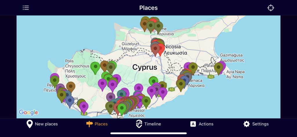
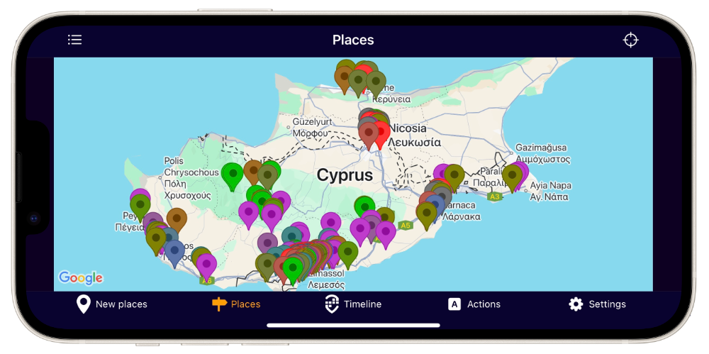
Looking at my Cyprus map today, I can see hundreds of colorful pins scattered across the island – from the bustling streets of Nicosia to the serene beaches of Ayia Napa, from mountain villages like Polis to coastal gems like Limassol. Each pin represents not just a place, but a moment in our family’s story tracked by this powerful travel tracker.
Beyond Location: Photos and Stories in Your Travel Journal
What makes Acti more than just a basic travel tracker is the ability to attach photos and comments to each visit. When I tap on the pin marking our favorite restaurant in Larnaca, I see the photo of my daughter’s first taste of halloumi and my note about how the owner remembered our order after just three visits.
The purple pins clustering around Limassol tell the story of our weekend routine – Saturday morning walks along the marina, Sunday visits to the old town, and countless afternoons at our favorite beach café. Each location holds multiple visits, creating a comprehensive travel tracker timeline of how places became meaningful to us over time.
Creating a Complete Life Travel Tracker Timeline
Unlike traditional travel trackers that capture only vacation highlights, Acti documented our entire life in Cyprus. The map shows not just tourist attractions, but the grocery stores where we shopped, the parks where our daughter took her first steps, the medical centers we visited, and the friends’ homes where we shared countless dinners.
This comprehensive travel tracker approach means I have a complete record of our expatriate experience. The dense cluster of pins in our neighborhood tells the story of daily life, while the scattered pins across the island chronicle our weekend adventures and exploration of Cyprus’s hidden treasures.
The Emotional Value of a Visual Travel Journal
Seeing all our Cyprus visits laid out on one map creates an emotional connection that traditional travel trackers can’t match. The geographic spread shows how we gradually explored further from our home base, becoming more confident and adventurous as locals rather than tourists.
The color-coded pins (each representing different categories or time periods) reveal patterns I never noticed while living them. Green pins cluster around nature spots where we sought weekend escapes, while red pins mark the restaurants that became our regular haunts. This visual travel tracker approach transforms scattered memories into a coherent story.
Why Every Traveler Needs a Digital Travel Journal
Whether you’re planning a short vacation or, like me, embarking on a multi-year international adventure, a digital travel tracker like Acti offers something traditional travel trackers can’t: the ability to see your entire journey at once.
My Cyprus map isn’t just a record of places visited – it’s a visual autobiography of 2.5 transformative years. It shows how two adults and a newborn became a family, how strangers in a foreign country found their rhythm and favorite spots, and how a temporary stay became a meaningful chapter in our lives through the power of consistent travel tracker documentation.
Every pin on this map represents a decision to explore, a moment of discovery, or simply the mundane beauty of daily life in a new place. Together, they create something more valuable than any traditional travel tracker could capture: a complete, visual story of our time in Cyprus that I can revisit whenever nostalgia calls.
Ready to start creating your own visual travel tracker?
Embark on a Seamless Journey of Memories with the Perfect Travel Diary App
Forget frantic note-taking and lost memories! This list of the top 8 travel diary apps for iOS helps you effortlessly chronicle your adventures. Whether you’re a meticulous planner, a spontaneous explorer, or a privacy-conscious globetrotter, discover the perfect travel diary app to capture every detail, from hidden gems to epic moments. We’ll explore powerful features, from GPS tracking and photo integration to seamless Apple Watch and Health app syncing. Find your ideal travel companion below!
Are you a globetrotter yearning for a seamless way to chronicle your adventures without compromising your privacy? Do you dream of a travel diary app that effortlessly captures your journeys, enriching your memories with vibrant details and insightful summaries? Then look no further than Acti, the intuitive iOS app designed for the modern traveler, memory keeper, and privacy-conscious explorer. Acti stands out in the crowded field of travel journal apps by prioritizing user privacy while offering a rich suite of features to document and relive life’s precious moments. It’s your personal time machine, neatly packaging your experiences for easy access and reflection.
Forget cumbersome manual entries and complicated setups. Acti automatically logs your visits to known places using secure, on-device location data. This means no registration is required and your data isn’t stored in the cloud, ensuring your privacy is paramount. Imagine effortlessly building a comprehensive travelogue simply by living your life! As you explore new destinations, Acti quietly works in the background, creating a detailed record of your adventures.
But Acti is more than just a location tracker; it’s a powerful memory enhancer. Enrich your travel entries with photos, capturing the breathtaking views and vibrant cultures you encounter. Add personal comments to recall the emotions and anecdotes that make each experience unique. Rate your visits to remember your favorites and easily share your hidden gems with friends and family on social media. Want to inspire others with your journeys? Acti makes it simple to share your favorite spots, complete with photos and comments.
Reliving your adventures is just as effortless with Acti’s customizable timeline views. Browse your travel history by day, week, month, or even year, rediscovering the magic of past trips with a simple tap. The app also provides detailed summaries of your visits, categorized by location and offering fascinating insights into your travel patterns. Curious how many times you’ve visited that charming Parisian cafe? Acti provides one-click access to a complete visit history of any place, transforming scattered memories into organized, meaningful narratives.
For those invested in a holistic view of their well-being, Acti seamlessly integrates with the iOS Calendar and Health apps, including Apple Watch support. This integration paints a comprehensive picture of your activities, blending your travel data with your wellness information for a truly integrated life log. Imagine seeing your steps taken while exploring ancient ruins or tracking your sleep quality in a remote mountain cabin – Acti makes it possible!
Acti’s commitment to accessibility is reflected in its multilingual support. Currently available in English, Russian, and Spanish, with German and French versions on the horizon, Acti caters to a global community of explorers. Learn more about Acti and how it can help you visualize your world travels. It’s the perfect companion for frequent travelers, memory enthusiasts, and privacy-focused individuals seeking an effortless way to capture and relive life’s moments.
While Acti currently thrives in the iOS ecosystem, its absence on Android might disappoint some users. Also, the upcoming German and French language options are still under development. However, for iOS users, the pros significantly outweigh the cons. The automatic, privacy-focused location tracking, combined with rich journaling features and seamless iOS integration, sets Acti apart. It earns its top spot on our list of travel diary apps as a powerful, intuitive, and privacy-respecting tool for documenting and cherishing life’s adventures. Acti transforms the act of remembering from a chore into a joy, empowering you to create a rich tapestry of your life’s journey, one adventure at a time.
2. Polarsteps: Your Effortless Travel Companion
Are you a globetrotter who loves reliving your adventures but dreads the tedious task of manually documenting every detail? Say hello to Polarsteps, the automatic travel diary app that transforms your journeys into stunning visual stories with minimal effort! This app is a game-changer for frequent travelers, memory journaling enthusiasts, and anyone who wants to capture their trips beautifully and effortlessly. It’s the perfect blend of automated tracking and personalized storytelling, allowing you to focus on experiencing the moment rather than meticulously recording it.
Polarsteps seamlessly integrates with your phone’s GPS to automatically track your route, even when you’re offline. Imagine trekking through the Himalayas or exploring a remote island – Polarsteps diligently records your path, ready to be unveiled when you reconnect. Back in civilization? Your journey unfolds on a vibrant, interactive map, showcasing every step of your adventure. Think of it as a personalized cartographer charting your explorations, creating a unique visual record of your travels.
But Polarsteps is more than just a GPS tracker. It’s a powerful storytelling platform. Add photos, videos, and detailed notes to each point on your map, transforming your route into a rich narrative. Describe that delicious street food you discovered in Bangkok, the breathtaking sunset you witnessed in Santorini, or the friendly locals you met in a small Irish pub. These personalized touches bring your travel map to life, allowing you to relive those precious moments with vivid clarity.
Sharing your adventures is equally effortless. Polarsteps generates a shareable travel blog, allowing you to easily update friends and family on your journey. You can choose to share your entire trip or select specific moments, giving you complete control over your travel narrative. This feature is a boon for travel bloggers and social media enthusiasts, providing a visually stunning platform to share their experiences with the world.
Polarsteps caters to various travel styles and budgets. The free version offers a wealth of features, including automatic travel tracking, basic map customization, photo integration, and sharing options. For the power user, the Polarsteps Supporter plan unlocks additional features like unlimited trip backups, detailed travel statistics, and advanced customization options. This premium subscription ensures your memories are securely stored and enhances your storytelling capabilities.
While Polarsteps excels in automated tracking and visual presentation, it’s important to be aware of its limitations. Continuous GPS usage can impact battery life, so carrying a portable charger is advisable for extended trips. Customization options for the diary layout are somewhat limited compared to other travel diary apps. Additionally, some premium features require a subscription, and the app’s performance can be affected in areas with weak GPS signal.
Setting up Polarsteps is a breeze. Download the app from the App Store or Google Play Store, create an account, and you’re ready to go! Grant the app access to your location, and it will begin tracking your movements automatically. Before embarking on a trip, consider enabling offline maps within the app to navigate and track your journey even without internet access.
Compared to traditional travel journaling methods or even other digital diary apps, Polarsteps significantly reduces the effort required to document your travels. Its automatic tracking and visual map-based diary provide a unique and engaging way to relive your journeys. While apps like Day One offer more robust journaling features and TripIt focuses primarily on itinerary management, Polarsteps stands out with its effortless tracking and visually appealing presentation.
For those who value privacy, especially iOS users, Polarsteps offers granular control over location sharing. You can choose to keep your trips private or share them with select individuals. The integration with Apple Watch and Health app adds another layer of convenience, allowing you to track your steps and activity levels while traveling.
So, if you’re a frequent traveler, a social media enthusiast, or simply someone who cherishes travel memories, Polarsteps is an invaluable tool. Its effortless tracking, stunning visuals, and easy sharing options make it a must-have travel companion. Visit their website at https://www.polarsteps.com and start documenting your adventures today!
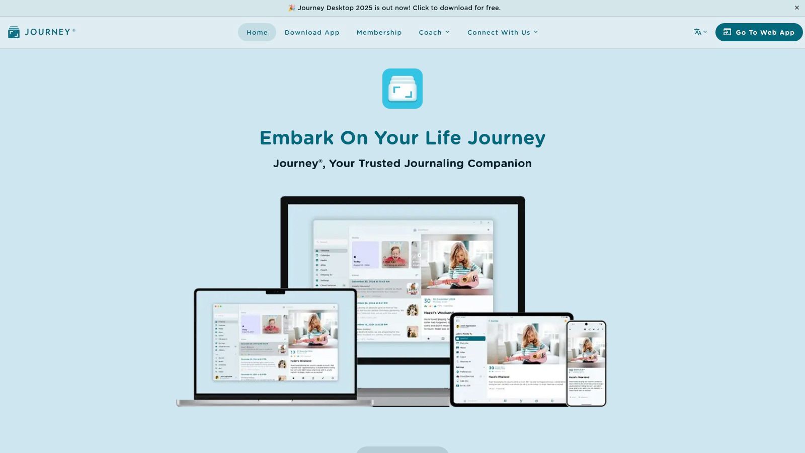
3. Journey
Journey is more than just a digital notepad; it’s your personal time machine, meticulously preserving every detail of your adventures and daily reflections. Designed for both avid travelers and daily journal keepers, Journey empowers you to craft rich, multimedia narratives of your experiences. Imagine effortlessly weaving together text, photos, videos, and even audio recordings to create a vibrant tapestry of your memories. Forget flimsy paper notebooks and scattered notes; with Journey, your entire travel history, complete with the sights, sounds, and emotions, resides securely in your digital pocket.
This travel diary app distinguishes itself with its commitment to a clean, intuitive interface paired with powerful organization features. Whether you’re a meticulous planner or a spontaneous explorer, Journey adapts to your style. Its rich text editor rivals desktop word processors, offering a range of formatting options to enhance your writing. Embed vivid photographs of breathtaking landscapes, insert videos of bustling markets, and even include audio recordings of local music to truly immerse yourself in your past journeys. The app seamlessly integrates location and weather data, automatically tagging your entries with the precise context of your experiences. Years later, you can revisit these entries and be instantly transported back to that specific moment in time. Learn more about Journey in this helpful article: Learn more about Journey.
For the frequent traveler and globetrotter, Journey becomes an indispensable companion. Imagine exploring a new city and effortlessly documenting every discovery, from hidden cafes to stunning street art, all within a single, organized platform. Privacy-conscious iOS users will appreciate Journey’s robust security features, ensuring your personal reflections remain just that – personal. Travel bloggers and social media enthusiasts will find the multimedia capabilities invaluable for crafting engaging content. Capture high-quality photos and videos directly within the app, add insightful captions, and effortlessly share your curated experiences with your audience. For memory journaling and life-logging enthusiasts, Journey provides a structured yet flexible space to record daily thoughts, track personal growth, and reflect on life’s journey.
Journey’s powerful search and filtering capabilities make retrieving specific memories a breeze. Searching for “sunset in Bali” will instantly surface all relevant entries, photos, and videos, allowing you to relive those magical moments in seconds. This feature is particularly useful for researchers, writers, or anyone who values efficient access to their archived information. Compared to other apps that may focus solely on text-based entries, Journey’s multimedia support elevates your journaling experience, transforming static memories into dynamic, immersive stories.
While Journey offers a free version with core features, unlocking the full potential of this travel diary app requires a premium subscription priced at $4.99/month. This unlocks cloud synchronization across multiple devices, ensuring your precious memories are always accessible, whether you’re on your phone, tablet, or computer. The seamless synchronization also serves as a vital backup, safeguarding your travel chronicles against device loss or damage. While this subscription model may be a drawback for some, the added value of seamless accessibility and data security makes it a worthwhile investment for serious journal keepers.
For new users, Journey’s extensive features might initially seem overwhelming. The app’s focus on comprehensive documentation can be a bit much for those seeking a simple, minimalist diary experience. Additionally, while Journey excels in private journaling, its social sharing features are less developed compared to other platforms. However, for those seeking a robust, feature-rich travel diary app with a strong emphasis on privacy and organization, Journey is a top contender. Its excellent writing and formatting tools, seamless synchronization, and support for various media types make it an invaluable tool for capturing and preserving your travel memories in all their vibrant detail. So, embark on your next adventure with Journey by your side and transform your travel experiences into timeless, interactive stories. You won’t regret it!
4. Day One
Day One is more than just a travel diary app; it’s a sophisticated digital sanctuary for your memories, meticulously crafted for the discerning traveler. If you’re serious about documenting your journeys with elegance and depth, Day One is a strong contender for your go-to travel companion. Its premium interface, coupled with a wealth of powerful features, makes it a joy to chronicle your adventures, big or small. Imagine effortlessly weaving together location data, weather conditions, and activity information into a rich tapestry of your travel experiences. Day One makes this a reality, automatically capturing this metadata in the background so you can focus on living in the moment. It’s designed for those who value a seamless and enriching journaling experience. From weekend getaways to epic expeditions, Day One helps you preserve the essence of your travels in a way that simple note-taking apps just can’t match.
One of Day One’s most compelling features is its automatic metadata capture. Imagine you’re hiking through a breathtaking mountain range. Day One automatically logs your location, the altitude, the weather conditions, and even the type of activity you’re engaged in (thanks to integration with the Apple Health app and Apple Watch). Later, when you revisit your entry, you’ll be transported right back to that moment, reliving the experience with vivid detail. This automatic data enrichment is a game-changer for travel journaling, adding layers of context that truly bring your memories to life. Furthermore, Day One supports multiple photos per entry with various rich layout options, allowing you to visually showcase your journey in a stunning and organized manner.
For those who prefer to narrate their experiences on the go, Day One offers voice recording and transcription. Simply speak your thoughts into the app, and Day One will convert your spoken words into text, saving you valuable time and effort. This is particularly handy when you’re on the move and don’t have the time to type out lengthy entries. Imagine dictating your impressions of a bustling marketplace in Marrakech or capturing the sounds of a tranquil beach in Bali – Day One makes it all effortless.
Privacy-conscious travelers will appreciate Day One’s robust end-to-end encryption. Your travel journal is a deeply personal document, and Day One ensures that your memories are kept safe and secure. This level of encryption gives you peace of mind knowing that your private thoughts and experiences remain private. Multiple export formats and backup options are also available, providing flexibility and ensuring that your precious memories are never lost.
Compared to simpler travel diary apps or general note-taking tools, Day One offers a significantly richer and more immersive journaling experience. While apps like Bear and Evernote provide basic note-taking functionality, they lack the specialized features and elegant design that make Day One so appealing for travel journaling. Day One’s focus on metadata, rich media support, and strong privacy features sets it apart as a dedicated travel diary solution.
Day One does come with a premium price tag. The subscription model, costing $34.99/year, unlocks the full potential of the app, including unlimited photos and videos, end-to-end encryption, and advanced features. While this might be a deterrent for casual users, serious travel journalers will find the investment worthwhile. It’s important to note that the app is primarily iOS-focused, with the Android version having fewer features.
Setting up Day One is incredibly straightforward. Simply download the app from the App Store, create an account, and you’re ready to start documenting your journeys. A few implementation tips: explore the various entry options (text, photo, audio), experiment with the different layout options for photos, and customize the metadata settings to capture the information most relevant to your travel style. Visit their website (https://dayoneapp.com) to explore the full range of features and benefits.
For frequent travelers, globetrotters, privacy-conscious iOS users, travel bloggers, and anyone passionate about preserving their memories, Day One is an invaluable tool. While the subscription cost might be a consideration, the app’s premium features, seamless user experience, and robust security make it a compelling choice for those who want to elevate their travel journaling to the next level.
5. TripIt: Your Master Travel Organizer & Unintentional Diary
For the meticulously organized traveler, TripIt is a dream come true. More than just a travel diary app, TripIt acts as your personal travel agent, effortlessly consolidating all your trip details into a neat, accessible itinerary. Forget frantically searching through emails for flight confirmations or hotel bookings – TripIt gathers everything in one place, building a comprehensive record of your travels, almost like a diary, albeit a highly structured one. This makes TripIt an invaluable tool for frequent flyers, business travelers, or anyone who appreciates the peace of mind that comes with having all their travel information at their fingertips. While its primary focus is organization, its ability to automatically document your trips makes it a worthy contender in the travel diary app arena.
TripIt’s magic lies in its automation. Simply forward your booking confirmation emails to plans@tripit.com, and the app automatically extracts the key details – flight times, hotel addresses, car rental information, and more – and weaves them into a master itinerary. This feature alone saves countless hours of manual organization and eliminates the risk of misplacing crucial documents. Imagine arriving at the airport only to realize you’ve left your hotel booking confirmation at home – a nightmare scenario TripIt completely prevents.
Beyond its core organizational prowess, TripIt offers features that enhance its travel diary capabilities. You can add notes to your itinerary, jotting down memorable moments, restaurant recommendations, or even the name of that charming local you met at the market. These personalized additions transform your itinerary from a dry list of logistics into a vibrant record of your experiences. Think of it as a structured framework for your travel memories, ready to be fleshed out with your personal touch.
For the data-driven traveler, TripIt provides fascinating travel statistics. See how many miles you’ve flown, countries you’ve visited, and even the total time spent in the air. This feature is not only fun but can also be surprisingly insightful, offering a unique perspective on your travel habits.
While TripIt excels at organization, it’s important to acknowledge its limitations as a dedicated travel diary app. Compared to apps specifically designed for journaling, its creative features are somewhat limited. You won’t find options for rich text formatting, photo albums, or interactive maps, for instance. It’s more about documenting the “what” and “where” of your travels than the “how” and “why.”
TripIt offers a free version that covers the basics of itinerary creation and document storage. However, to unlock premium features like real-time flight alerts, trip sharing with family and friends, and detailed travel statistics, you’ll need to subscribe to TripIt Pro for $49/year. While the price might seem steep, consider the value it brings in terms of time saved and peace of mind gained, especially for frequent travelers.
Getting started with TripIt is incredibly easy. Simply create an account, forward your booking confirmations, and watch your travel diary take shape. The app is available on both iOS and Android, and its web-based interface allows access from any device with an internet connection. While the automatic features rely on email forwarding, manual entry is also possible for those concerned about email privacy.
In conclusion, TripIt might not be a dedicated travel diary app in the traditional sense, but its powerful organizational features and ability to automatically document your trips make it a valuable tool for any globetrotter. If you prioritize efficiency and appreciate having all your travel information meticulously organized, TripIt deserves a prominent place in your digital travel toolkit. It’s the perfect solution for those who want a comprehensive travel record without the extra effort of dedicated journaling. Check it out at https://www.tripit.com and experience the joy of effortless travel organization.
6. Travelogue: Your Simple Yet Powerful Travel Diary Companion
Are you a globetrotter yearning to capture every precious moment of your adventures? Do you dream of a seamless way to document your travels without the fuss of complex apps? Look no further than Travelogue, a dedicated travel diary app designed specifically for chronicling your explorations. This intuitive platform empowers you to craft rich, detailed travel journals filled with photos, notes, and location information, all while keeping the process simple and enjoyable. If you’re seeking a straightforward yet effective way to preserve your travel memories, Travelogue might just be your perfect match. This travel diary app offers a refreshing approach to digital memory keeping, allowing you to focus on the experience rather than the technicalities.
Travelogue earns its spot on this list because it strikes a perfect balance between functionality and ease of use. While some travel diary apps overwhelm users with a plethora of features, Travelogue prioritizes simplicity without sacrificing essential tools. This makes it an ideal choice for both tech-savvy travelers and those seeking a more streamlined approach to documentation. Imagine effortlessly adding photos, jotting down notes about that delicious local cuisine, and automatically tagging your location, all within a clean and intuitive interface. That’s the Travelogue experience.
One of Travelogue’s standout features is its trip-based organization system. No more scrolling through endless entries to find a specific trip! Travelogue allows you to neatly categorize your journeys, making it easy to revisit past adventures and relive those special moments. Within each trip, you can create detailed entries with photos, notes, and even integrate expense tracking. This is particularly handy for budget-conscious travelers who want to keep tabs on their spending while exploring the world. Forget about separate budgeting apps; Travelogue has you covered.
For the visually inclined, Travelogue boasts photo galleries with location tagging. This allows you to showcase the stunning landscapes and vibrant cultures you encounter, all while preserving the context of where each photo was taken. Imagine sharing your travelogue with friends and family, effortlessly guiding them through your journey with visually rich narratives. It’s like creating your own personalized travel documentary. As a frequent traveler and globetrotter, this visual aspect of Travelogue can truly elevate your travel journaling experience.
Are you a privacy-conscious iOS user? Another major advantage of Travelogue is its robust offline functionality. You can access and edit your diary entries even without an internet connection, making it a reliable companion for adventures off the beaten path. This is particularly valuable for international travelers who may not always have access to Wi-Fi or mobile data. Jot down your thoughts, snap photos, and rest assured that your precious memories are safely stored, regardless of connectivity.
Travelogue also offers convenient export options for sharing and backup. You can easily share your travelogues with loved ones or export them as a backup, ensuring that your memories are preserved for years to come. For travel bloggers and social media enthusiasts, this feature is a game-changer, allowing you to seamlessly share your adventures with your online audience.
While Travelogue excels in simplicity and core functionality, it does have some limitations. Advanced formatting options are somewhat restricted, and the user community and support are smaller compared to more established platforms. The design, while clean and functional, might feel basic compared to some premium alternatives. Furthermore, integration with other travel services is currently limited.
While pricing and technical requirements for Travelogue aren’t available in this context, we encourage you to explore their website and learn more about Travelogue to stay up-to-date on the latest information. For those interested in delving deeper into the world of digital memory keeping, this article provides valuable insights and inspiration.
If you are a memory journaling and life-logging enthusiast, or if you are an Apple Watch and Health app user looking for a simple and effective travel diary app, Travelogue might be the perfect tool for you. It seamlessly integrates with your travel lifestyle, providing an intuitive platform to document your experiences and preserve your precious travel memories. Visit the Travelogue website to learn more and embark on your journey of digital travel documentation.
7. Travelog
Are you a traveler who loves to document every adventure, from the majestic mountains you climbed to the quaint cafes you discovered? Do you also thrive on sharing your experiences and connecting with fellow wanderers? If so, Travelog might just be the perfect travel diary app for you! This dynamic platform seamlessly blends personal journaling with a vibrant social community, allowing you to craft captivating travel stories while simultaneously discovering and following other explorers’ journeys. This travel diary app takes the best of both worlds and wraps them up in a user-friendly package.
Travelog shines as a social travel story sharing platform, making it a unique entry in the world of travel diary apps. While offering the core functionality of a personal diary—allowing you to chronicle your adventures with rich text and stunning photos—it also opens up a world of connection. Imagine stumbling upon a hidden gem in a remote village and instantly sharing that experience with a community of like-minded travelers. Or, picture yourself planning your next trip inspired by the breathtaking photos and detailed itineraries shared by others. That’s the magic of Travelog.
This travel diary app makes it incredibly easy to create visually appealing and engaging travel logs. The photo integration is seamless, allowing you to showcase your adventures with beautiful imagery. Add detailed captions, dates, locations, and even link relevant Wikipedia entries to add depth to your stories. Imagine effortlessly plotting your journey on a map, visually tracing your steps across continents, and sharing that interactive map with your followers. Travelog brings your journeys to life, transforming static entries into dynamic narratives.
One of Travelog’s standout features is its map-based travel visualization. Imagine reliving your adventures by tracing your route across a map, each point marked with photos and anecdotes. It’s not just a diary; it’s a visual storybook of your travels. This feature also makes it easy to discover new destinations, following the footsteps of fellow travelers who have ventured off the beaten path.
While Travelog thrives on its social aspect, it doesn’t compromise on personal privacy. The app provides granular privacy controls, letting you decide which entries are shared publicly and which remain private, tucked away in your personal travelogue. This makes it ideal for both social butterflies and introspective journalers. You can share as much or as little as you’d like, customizing your experience to fit your preferences.
For those constantly on the go, Travelog offers a free version with basic features. This allows you to experience the core functionality of the app before deciding if a premium subscription, which unlocks additional features, is right for you. Pricing details for premium features are not readily available on their website, however, suggesting contacting them directly for further information. The app requires an internet connection for most of its social features, like sharing your stories and viewing others’ posts. While offline functionality is limited, it still allows you to draft entries and save photos, ensuring that no precious memories are lost when you’re off the grid.
Compared to more traditional, private journaling apps like Day One, Travelog leans heavily into the social aspect of travel. This might not appeal to everyone, especially those who prefer a more introspective and private journaling experience. The constant connectivity and social feed might also prove to be a distraction for some, pulling them away from the mindful reflection that often accompanies travel.
However, for travel bloggers, social media enthusiasts, and those who find joy in sharing their experiences with a wider audience, Travelog’s social features are a game-changer. It’s a platform where your stories can inspire others, connect you with fellow travelers, and create lasting memories. The app offers a unique blend of personal reflection and social connection, catering to a niche that’s increasingly important in our interconnected world.
Ready to transform your travel memories into engaging stories? Head over to https://www.travelog.com and start exploring! Whether you’re a seasoned globetrotter or an aspiring adventurer, Travelog provides a dynamic platform to document your journeys and connect with a vibrant community of fellow explorers.
8. Esplorio: The Effortless Travel Diary App for the Modern Explorer
Are you a frequent traveler tired of meticulously documenting every detail of your adventures? Do you yearn for a seamless way to capture your journeys without the hassle of manual entry? If so, Esplorio, the automatic travel journal app, might just be your perfect travel companion. This innovative app leverages GPS tracking and smart technology to effortlessly create stunning visual timelines of your trips, making it a strong contender in the realm of travel diary apps.
Esplorio stands out for its completely hands-off approach to travel documentation. Imagine this: you’re exploring a vibrant new city, hopping between museums, cafes, and historical landmarks. Instead of constantly pulling out your phone to jot down notes and locations, Esplorio works silently in the background, tracking your movements and automatically creating a beautiful, interactive record of your day. This allows you to stay present in the moment and truly savor your experiences, knowing that your memories are being captured effortlessly. For the busy traveler or the memory journaling enthusiast, this is a game-changer.
One of Esplorio’s key strengths lies in its intelligent transportation detection. The app automatically identifies whether you’re walking, driving, flying, or even taking a train, enriching your travel timeline with contextual information. This feature is not only impressive from a technical standpoint but also adds a dynamic layer to your travel journal, allowing you to revisit not just where you went, but how you got there. This is particularly useful for road trips or multi-city adventures, where the journey itself becomes part of the story.
Esplorio seamlessly integrates with your photo library, automatically matching photos with the corresponding locations on your timeline. This eliminates the tedious task of manually geotagging your pictures and creates a visually rich and engaging travel narrative. Imagine scrolling through your Esplorio timeline and seeing your photos perfectly placed along your route, bringing your journey to life in a vibrant and interactive way. For travel bloggers and social media enthusiasts, this feature makes sharing your adventures a breeze.
Privacy-conscious iOS users will appreciate Esplorio’s focus on data security. While the app utilizes GPS and data connection, it’s designed with battery optimization in mind, minimizing its impact on your device’s power consumption. This ensures that you can track your travels throughout the day without worrying about draining your battery. Furthermore, the app integrates with the Apple Watch and Health app, allowing for a more holistic view of your travel experiences.
While Esplorio excels in automatic documentation, it’s important to acknowledge its limitations. The app offers limited manual editing and customization, which might be a drawback for users who prefer more control over their travel journals. Compared to more traditional, manual diary apps, Esplorio’s entries are less detailed and might not capture the nuances of personal reflections or specific experiences. Additionally, the app requires a consistent GPS and data connection, which can be a challenge in remote areas or when traveling internationally. Finally, due to its reliance on GPS, Esplorio may miss indoor activities or detailed experiences that occur within a specific location.
Despite these limitations, Esplorio shines as a travel diary app for those who prioritize effortless documentation and a visually appealing presentation of their travel data. It’s perfect for capturing the broad strokes of your journeys and creating beautiful, shareable travel stories with minimal effort.
Currently, Esplorio is available for iOS devices. Pricing details can be found on their website (https://esplorio.com). If you’re an avid traveler seeking a hands-off approach to travel journaling, Esplorio is definitely worth exploring. Download the app and start effortlessly documenting your next adventure!
Travel Diary Apps Feature Comparison
App
Core Features
User Experience
Value Proposition
Target Audience
Price Point
Acti
Auto visit tracking; Journaling w/ photos, comments, ratings; iOS Calendar & Health integration
Privacy-first; Custom timelines; Multi-language support
Social sharing; Photo-rich stories; Map visualization
Social-focused; Inspiring community
Combine journaling & social travel
Social travelers; explorers
Free
Esplorio
Auto GPS travel tracking; Transport mode detection; Visual timelines
Hands-off; Battery optimized
Effortless automatic travel diary
Users wanting minimal input
Free
Preserve Your Travel Adventures: Choosing the Right Travel Diary App
From automatic trip logging with apps like Polarsteps and TripIt, to rich multimedia journaling with options like Journey and Day One, and even social sharing features found in Travelogue, Travelog, and Esplorio, the perfect travel diary app is out there waiting for you. We’ve explored a diverse range of tools, each with its own strengths, catering to various travel styles and tech preferences. Remember, the key to choosing the right travel diary app lies in understanding your individual needs. Are you a privacy-conscious iOS user who values seamless Apple Watch and Health app integration? Perhaps you’re a travel blogger eager to share your adventures with the world? Or maybe you simply cherish the idea of a beautifully crafted digital memory journal to look back on for years to come. Consider factors like offline accessibility, photo storage options, and the level of customization available when making your decision.
Choosing the right travel diary app transforms how you document and relive your journeys. It’s more than just recording where you’ve been; it’s about capturing the essence of your experiences – the sights, sounds, tastes, and emotions that make each trip unique.
Ready to elevate your travel journaling and preserve your adventures in a truly meaningful way? Start capturing your next adventure with Acti, a powerful travel diary app designed for seamless memory keeping. Discover more and download Acti today at Acti!
What Makes Travel Tracker Apps Your Secret Travel Weapon
Think of that friend who glides through airports, never misses a flight, and somehow discovers the coolest hidden spots. They’re organized, prepared, and seem to have a sixth sense for travel. That’s the power you unlock with a travel tracker app, your digital co-pilot for smoother adventures. These apps aren’t just about itineraries anymore; they’re about transforming stressful trips into enjoyable journeys.
These apps have come a long way from basic digital calendars. They’ve evolved into smart systems that anticipate your needs, recommend the best routes, and even uncover those off-the-beaten-path experiences you’d otherwise miss. It’s like having a network of trusted friends whispering insider tips throughout your trip, personalized just for you. This represents a real shift in how we travel, going from simply reacting to problems to proactively discovering opportunities.
Imagine touching down in a new city after a red-eye flight. Instead of frantically searching for Wi-Fi to access your hotel booking, your travel tracker app has it readily available offline. Need the closest metro station? Boom, it’s right at your fingertips. This instant access to key info takes the edge off and allows you to explore new places with confidence.
This screenshot from TripIt shows how these apps pull all your travel information – flights, hotels, rental cars – into one clean, organized view. The visual layout makes it easy to find what you need in a second, freeing you from juggling multiple confirmations and messy itineraries.
The growing popularity of these apps reflects a larger change in how we travel. The travel app market is booming, generating $629 billion in revenue in a recent year, a 13% jump from the year before. With over 850 million people using travel apps worldwide in 2023, it’s clear travelers value having a central, easy-to-use hub for managing their trips. Discover more insights on the travel app market. But with so many apps out there, how do you pick the right one? Let’s explore the key features that separate the truly great travel tracker apps from the rest.
From Paper Chaos To Digital Brilliance: The Travel Tech Revolution
Remember lugging around those heavy travel folders, overflowing with printed emails, confirmations, and handwritten notes? It wasn’t that long ago, but it feels like a different era. Thankfully, technology has come to the rescue of weary travelers. The evolution from that analog chaos to the sleek efficiency of today’s travel tracker apps is a fascinating story of innovation.
This screenshot from Wikipedia gives us a peek behind the curtain of mobile app development, the very process that brings travel tracker apps to life. Notice the different stages – planning, design, development, testing, and deployment. Building a smooth, user-friendly app is a complex undertaking. This rigorous process helps explain why some travel apps are a joy to use, while others…well, let’s just say they leave room for improvement.
Think back to the first flight tracking websites. Compared to shuffling through papers, they were a breath of fresh air, but they were still pretty basic. Then smartphones arrived, and suddenly, managing travel details went from a logistical nightmare to something you could handle on the go. This wasn’t just about adding fancy features; it was about solving real problems for travelers.
The Rise of the Travel Tracker App
Let’s picture Sarah, a management consultant who’s constantly hopping between cities for meetings. Before travel tracker apps, her life was a blur of paper itineraries and endless checking of confirmations. Now, she effortlessly manages intricate, multi-country trips from her phone, adjusting to last-minute changes without breaking a sweat.
Or consider the Rodriguez family. Imagine their teenage son getting separated from them in a crowded European city. A terrifying thought, right? With shared itineraries and real-time location sharing through their travel app, what could have been a crisis became a minor blip. Peace of mind, delivered via technology.
Even budget-conscious backpackers like Marcus benefit. He uses expense tracking and local discovery features to make his travel funds stretch further, experiencing more without overspending. These real-world examples show how travel tracker apps have become game-changers for all types of travelers.
The Evolution of Essential Features
Smartphones did more than just digitize paper documents. They opened up a world of possibilities for features that truly enhanced the travel experience. Think instant access to your boarding pass even when you’re offline, real-time flight updates that keep you in the loop, and smooth integration with other travel services. These features went from being nice-to-haves to must-haves.
But not all features are created equal. Some, like automated itinerary builders, quickly became essential, while others, like augmented reality overlays, just didn’t catch on. The key to success? Focusing on what travelers actually need, not just chasing the latest tech trends. The best travel tracker apps today take this a step further, offering personalized recommendations and proactive assistance. They anticipate your needs, suggesting alternative routes during flight delays or offering local tips based on your interests. This shift from reactive to proactive support is what sets the modern travel tracker app apart.
Essential Features That Actually Matter When You’re On The Road
Not all travel tracker apps are born equal. Some have bells and whistles that look impressive in screenshots but don’t hold up in real-world travel scenarios. Knowing which features will actually save your trip (versus just looking fancy) can make all the difference when flights get canceled, hotels misplace reservations, or your carefully laid plans go sideways. Let’s cut through the marketing hype and focus on what truly matters when you’re on the move.
This infographic showcases the power of a minimalist design. Think of it like the dashboard of a well-organized car – everything you need is within easy reach. A clean, uncluttered interface in a travel tracker app lets you quickly input your trip details, from picking your destination to logging and saving all your important information. This simplicity becomes invaluable when you’re juggling the stress of unexpected travel hiccups.
Must-Have Features for Every Travel Tracker App
Your travel tracker app should be your digital Swiss Army knife, equipped with the essential tools you need at a moment’s notice. These core features are more than just window dressing; they’re your lifeline when travel throws you a curveball.
Offline Access: Picture this: you land in a new country, your phone has no Wi-Fi, and you desperately need your hotel confirmation. Offline access is your backup plan when connectivity goes AWOL. It lets you access crucial documents, from boarding passes to booking details, no matter where you are.
Real-Time Updates: Flight delays, gate changes, and unexpected schedule shifts are all part of the travel game. Real-time updates are your eyes and ears on the ground, sending instant notifications about any changes that could impact your journey.
Itinerary Management: More than a simple digital to-do list, itinerary management brings all your trip components together – flights, hotels, rental cars, tours – into a single, organized hub. This centralized system streamlines your planning and provides a clear overview of your entire adventure.
Trip Collaboration: Traveling with a group? Trip collaboration lets everyone access and contribute to the itinerary, ensuring everyone stays in sync. This shared view eliminates confusion and keeps everyone updated with the latest information.
This screenshot from Kayak Trips shows how a well-designed interface can transform a complicated itinerary into a manageable overview. It’s like having a bird’s-eye view of your trip, allowing you to easily manage all the moving parts.
Beyond the Basics: Features That Enhance Your Journey
While the essentials are crucial, certain features elevate a travel tracker app from helpful to indispensable. These additions, although not strictly required, can greatly enrich your travel experience and provide a deeper level of support.
Expense Tracking: Keeping track of your spending on the road can be a hassle. Integrated expense tracking simplifies budgeting and prevents those post-trip financial surprises.
Document Storage: Passports, visas, travel insurance – these vital documents need to be readily accessible. Secure document storage within the app acts like a digital safe for all your important paperwork.
Offline Maps and Navigation: Getting lost in an unfamiliar city can quickly derail your plans. Offline maps and navigation give you a sense of direction even without internet access, empowering you to explore with confidence.
Customizable Alerts: Not all notifications are created equal. Customizable alerts give you control over which updates you receive, filtering out the noise and highlighting the information that matters most. For more information on how location tracking can enhance your travels, take a look at this: Check out our guide on location history apps.
The right travel tracker app is more than just a planning tool; it’s your trusted travel companion. By understanding which features truly make a difference, you can choose an app that empowers you to navigate any travel challenge with confidence and ease.
To help you further evaluate different travel tracker apps, let’s look at a comparison of essential and premium features:
The table below, “Essential vs. Nice-to-Have Travel Tracker Features”, breaks down core functionalities against premium offerings and provides a user priority rating based on general traveler feedback. This will help you discern which features are truly essential and which ones fall into the “nice-to-have” category.
As you can see, features like itinerary management and offline access are highly valued due to their practical impact on travel organization and accessibility. While premium features like advanced communication tools and safety enhancements can be beneficial, they often hold a lower priority for the average traveler. Choosing an app with a solid foundation of essential features is key to a smooth and stress-free travel experience.
Real Travelers, Real Stories: How Apps Transform Different Journeys
Travel tracker apps aren’t just digital accessories; they’re transforming how we experience journeys. Let’s look at a few examples to see how these apps cater to different travel styles. Consider Sarah, a management consultant constantly on the go, juggling flights and meetings across multiple cities in a single week. For her, a travel tracker app is indispensable, keeping her organized amidst constant flight changes and tight connections. It’s her secret weapon for navigating the complexities of business travel.
Then there’s the Rodriguez family, whose European adventure could have taken a disastrous turn. Imagine the stress of a teenager separated from their family in the crowded streets of Rome. Thanks to the real-time location sharing feature on their travel tracker app, they were quickly reunited, saving precious vacation time and avoiding a potential crisis.
This screenshot from Google Travel showcases how visually appealing and informative these apps can be. All your essential trip details—flights, hotels, even suggested activities—are neatly organized in one place. This centralized hub simplifies travel planning and eliminates the need to juggle multiple apps or websites.
Now, let’s shift gears to Marcus, the budget backpacker exploring Southeast Asia. For him, a travel tracker app is a financial lifesaver. It helps him track expenses and discover local gems, ensuring he gets the most out of his limited funds. Finding affordable food and hidden spots becomes an integral part of his adventure, all thanks to the app. These diverse scenarios demonstrate how the right travel tracker app can truly empower any journey.
How Real-World Experiences Shape App Development
These stories aren’t just interesting anecdotes; they’re the foundation upon which travel tracker apps are built and improved. Developers pay close attention to user experiences, constantly refining features and adding new functionalities based on real-world feedback. For instance, the need for offline access emerged after travelers found themselves stranded without Wi-Fi, unable to access crucial information. Similarly, the importance of collaborative features like real-time location sharing became apparent when families experienced the peace of mind it provided. For a deeper dive into the world of travel trackers, check out this insightful post.
The evolution of travel tracker apps also mirrors broader trends in the travel industry. The rise of group travel, particularly among millennials and Gen Z, has spurred the demand for more specialized apps. In fact, the market value of group travel planning apps, often incorporating travel tracking as a key component, reached $245 million in 2025. This market is expected to maintain robust growth, with a projected CAGR of 8.1% through 2033. For more data on this trend, see this market report on group travel planning apps. These apps address the unique needs of group travelers, offering features like expense splitting, shared itinerary planning, and synchronized trip updates. This surge in popularity highlights the increasing role of technology in shaping the future of travel.
Protecting Your Privacy While Staying Connected On The Road
Your travel tracker app is a powerful tool. It can organize everything from your flight details to your dinner reservations. But this convenience has a trade-off: your privacy. These apps often know where you sleep, eat, and explore, creating a delicate balance between helpfulness and potential overreach. Understanding this balance is key for every traveler.
It’s important to take steps to protect your digital footprint. This section explores the data these apps collect, how it’s used, and how you can stay safe without sacrificing helpful features.
Understanding Data Collection and Usage
Think of your travel tracker app as a knowledgeable concierge. To give you personalized recommendations, it needs information about your preferences and travels. This might include your location, travel dates, booking details, spending habits, and even the activities you enjoy. This information helps create a seamless travel experience. However, it also raises important questions about how this data is used and protected.
For instance, some apps might use your location data to give you real-time traffic updates or suggest nearby restaurants. This can be incredibly useful. But it’s also important to be aware that this data could be shared with third-party advertisers. It might even be used to build targeted advertising profiles. Similarly, the app could analyze your spending habits to offer personalized travel deals, but this same information could be sold to marketing companies.
Taking Control of Your Privacy Settings
The good news is you don’t have to choose between convenience and privacy. Most travel tracker apps let you customize your privacy settings. This gives you control over your data. These settings range from limiting location tracking to turning off personalized recommendations. It’s like adjusting the blinds in your hotel room—you choose how much you reveal.
This screenshot from Apple’s support website shows you how to manage location services for individual apps. It visually demonstrates how you can fine-tune your privacy, only granting access to features you’re comfortable with. Carefully reviewing these options helps ensure your travel app only accesses the data it actually needs.
By understanding these settings and how they affect your app’s functionality, you can balance personalized assistance and data protection. You can make informed decisions about your digital privacy and still enjoy the benefits of a well-organized travel experience. For more information on location data privacy, read also: Location Data Privacy.
Traveling Across Borders: International Data Laws
International travel adds another layer of complexity to data privacy. Different countries have different rules about data collection and use. What’s acceptable in one country might be a privacy violation in another. Understanding these differences is essential for protecting your information abroad. This means researching the data privacy laws of your destination and adjusting your app settings accordingly.
Also, think twice about using public Wi-Fi to access your travel tracker app. These networks can be vulnerable to hacking, potentially exposing your sensitive information. A Virtual Private Network (VPN) adds a layer of security by encrypting your data and masking your IP address. This protects your privacy, particularly when using public Wi-Fi in countries with weaker data protection laws. By managing your privacy settings and being cautious on public networks, you can minimize risks to your data while traveling internationally.
Navigating The Travel App Jungle: Understanding Your Options
Picking a travel tracker app can feel like trying to find a specific tree in a dense rainforest. So many apps, all claiming to be the one. But the truth is, different apps have different strengths and cater to different travel styles. This guide helps you cut through the noise and find the app that’s right for you. We’ll explore the familiar faces, the exciting new kids on the block, and the specialist tools for every kind of traveler.
Understanding the Travel App Ecosystem
The world of travel apps is constantly changing and growing, fueled by our ever-increasing need for smooth and efficient travel planning. Knowing what kind of apps are out there is the first step to finding the perfect fit.
Comprehensive Travel Planners: Think of these as your all-in-one travel toolkit. They handle everything from booking flights and hotels to organizing your itinerary and keeping track of your spending.
Specialized Travel Trackers: These apps are laser-focused on documenting your journey. They’re great for logging where you’ve been and adding photos, notes, and stories along the way. TripIt, for instance, lets you simply forward your booking emails, and it magically creates a detailed itinerary for you.
Niche Travel Apps: These apps are designed for specific travel tribes, whether you’re a backpacker, a budget traveler, or part of a group adventure. They often have unique features tailored to those particular communities. Splitwise, for example, makes sharing expenses on group trips a breeze.
This screenshot shows how TripIt keeps everything organized in one place. Notice how easy it is to see your flight details, hotel reservations, and other bookings at a glance. This centralized view is especially useful when you’re juggling a complicated itinerary.
Choosing the right travel tracker app depends on a few things: your travel style, your comfort level with technology, and your budget. Some apps are free but show ads. Others offer premium subscriptions for extra features and an ad-free experience. What’s popular in one part of the world might be unheard of in another, reflecting the diversity of travel and the needs of travelers from different cultures.
The Business of Travel Apps
Just like any business, travel apps use different models to make money, and this impacts what you get as a user. Understanding these models can help you pick an app that aligns with your preferences.
Free, Ad-Supported Apps: These apps are free to use, but they show you ads to generate revenue. The trade-off for free access is a potentially less smooth experience and possible privacy concerns related to data collection for targeted advertising.
Freemium Apps: These offer basic features for free, but you can unlock more advanced features with a paid subscription. It’s a good balance between accessibility and getting more out of the app.
Paid Apps: You pay upfront for these apps, but they usually offer a more complete set of features and no ads. This often means a cleaner, more focused user experience.
Subscription-Based Apps: These apps charge a recurring fee, giving you ongoing access to features and updates. This often encourages developers to keep improving the app and adding new things.
To give you a sense of how big this industry is, the travel and tourism app market was valued at about $650.7 billion in 2024. It’s projected to reach a staggering $3,552.7 billion by 2034, growing at a CAGR of 18.5%. Explore the full market analysis. This incredible growth shows how important travel tracker apps are becoming in our digital world.
Let’s take a look at the market breakdown:
To illustrate regional differences in the market, we’ve compiled the following table:
Travel App Market Share by Region and Platform
Statistical breakdown of travel app adoption, revenue, and user preferences across different regions and device platforms
Region
Market Share
Revenue (Billions)
Dominant Platform
Growth Rate
North America
35%
$227.7
iOS
16%
Europe
28%
$182.2
Android
19%
Asia Pacific
22%
$143.1
Android
22%
Latin America
10%
$65.1
Android
25%
Rest of World
5%
$32.6
Android
15%
This table gives a snapshot of how travel apps are used and how much revenue they generate in different parts of the world. It highlights the dominant platform and the projected growth rate for each region. As you can see, while North America currently holds the largest market share, other regions, particularly Asia Pacific and Latin America, are experiencing rapid growth. This data emphasizes the global reach of the travel app market and the different dynamics at play in each region.
Finding Your Perfect Travel Tracker App Match
Choosing the right travel tracker app doesn’t have to be a gamble. Forget the flashy ads and focus on what you need. Think of it like picking the right shoes: you wouldn’t wear stilettos on a hike. Likewise, a complicated app built for a world traveler might be too much for a simple weekend trip.
This screenshot from the Google Play store shows just how many travel tracker apps are out there. It’s a bit overwhelming, right? Each app has its own features and look. To navigate this crowded space, you need to know what you’re looking for.
This huge selection underscores why you need a smart way to find the right app. Without a plan, you’ll likely download a bunch of apps before finding “the one.”
Matching Your Travel Style to App Features
Different travelers have different needs. Someone taking a few trips a year has different priorities than someone traveling the world full-time. Let’s look at a few examples:
The Business Traveler: Frequent flyers need an app that makes their lives easier. Real-time flight updates, automatic itinerary imports from email, and links to other business tools are important. Expense tracking and secure document storage can also be very helpful.
The Family Traveler: For families, it’s all about coordination. Shared itineraries, real-time location sharing for safety, and maybe even in-app messaging are key to keeping everyone on the same page.
Testing and Evaluating Your Options
Don’t just trust the app’s description. Test it out! It’s like a test drive before buying a car. Download a few apps that look promising and use their free trials to see how they work.
By following these steps, you can find a travel tracker app that fits your travel style, makes your trips better, and helps you handle any surprises along the way.
Ready to make travel easier and ditch the stress? Try Acti, an intuitive iOS app designed to capture and revisit your adventures. Download Acti now and start documenting your journeys easily and privately.
What Makes Digital Travel Journals Different (And Why It Matters)
Think of that friend who remembers everything about your trips together – every tiny detail, every funny moment, every inside joke. That’s the magic of a digital travel journal. Unlike a paper journal, vulnerable to spilled coffee or getting lost in a move, a digital journal is a safe, ever-evolving record of your adventures.
But it’s so much more than just typed-up notes. Digital travel journals have grown beyond simple note-taking apps. They’ve become powerful storytelling tools, weaving together photos, videos, locations, and even the emotions you felt at a particular moment. Imagine, years from now, not only seeing a picture of that amazing street food you ate in Bangkok, but also reading about how it tasted at 2 AM after a long day exploring. That’s the difference.
This shift to digital reflects a bigger change in how we travel and remember our experiences. The growth of digital travel has dramatically changed how we plan and document our trips. In fact, the digital travel market is expected to reach $484.18 billion by 2025, growing at a 14.2% CAGR from 2024. Factors like increased internet access, greater confidence in online transactions, and the widespread use of smartphones are driving this growth. You can find more information on the digital travel market here. This impressive growth shows just how important digital tools have become in shaping our travel journeys.
Digital travel journals offer more than just convenience. They become invaluable tools for reflection and planning future trips. They capture the details that make memories truly meaningful years down the line. Imagine searching your journal for “best sunset” and instantly finding every photo and entry related to those stunning moments. Try that with a traditional paper journal. This evolution in travel journaling lets you connect with your experiences on a much deeper level.
From Heavy Notebooks To Pocket Historians: The Digital Revolution
Remember those bulky travel journals, overflowing with postcards, ticket stubs, and scribbled notes? They were tangible records of our adventures, but also a bit of a burden. The shift to digital travel journals has changed how we capture and revisit our travels, offering a new way to interact with our memories.
Think about it: a backpacker spends three years traversing continents, diligently filling a notebook with stories and sketches. Then, disaster strikes – the notebook is lost. This scenario highlights the fragility of physical journals. A digital travel journal, backed up securely in the cloud, safeguards these precious memories. You can explore further in our guide on travel journal apps. It mirrors how we now use technology to document our lives, a fundamental shift in storytelling.
The Unexpected Perks of Going Digital
The move to digital has brought surprising advantages. Searching for “that incredible pasta dish in Rome” becomes a breeze, instantly surfacing photos and descriptions. Automatic location tracking adds context, mapping your journey with accuracy. Recalling precisely where and when you were is just a few taps away.
Sharing your experiences with family and friends back home becomes instantaneous, bridging the distance between your adventures and their daily lives. It’s like sending a virtual postcard in real-time.
The travel industry, now interwoven with these digital elements, is expected to reach $2,547.17 billion by 2033, a significant jump from $1,632.3 billion in 2025. This growth reflects the increasing demand for travel services integrated with technology. More insights can be found here. Digital tools haven’t simply replaced notebooks; they’ve unlocked new possibilities.
A New Era of Travel Storytelling
Imagine a family on vacation, each member contributing to a shared digital travel journal. Photos, videos, and anecdotes combine to create a collaborative narrative. This shared experience transforms travel documentation into a vibrant, evolving story, enriching the journey itself.
Digital journals empower us to become “pocket historians” of our personal adventures. We curate and preserve memories in ways never before possible. This shift has changed how we experience, remember, and share our travels, making every adventure more vivid and accessible.
Features That Actually Matter (And Those That Don’t)
The infographic above shows how flexible a digital travel journal can be. Think of organizing your memories by time, like a traditional diary, or grouping them by theme—like “Best Street Food” or “Mountain Views”—or even mapping them geographically. It’s a far cry from the limitations of a physical notebook. Speaking of digital memories, you might find this article on digital memory keeping interesting.
Essential Features For a Seamless Experience
Imagine your digital travel journal as your trusty travel backpack. You want it packed with helpful tools, not unnecessary weight. So, what are the absolute must-haves?
Offline Functionality: Picture this: you’re in a remote village, inspiration strikes, but your journal is useless without internet. Frustrating, right? Offline access is non-negotiable for capturing those spontaneous moments.
Smart Search: Have you ever tried finding a specific photo in a sea of hundreds? It’s like searching for a needle in a haystack. A robust search feature lets you quickly find memories by keywords, like “Paris sunsets” or “that amazing pasta dish.”
Seamless Photo Integration: Your journal should effortlessly work with your phone’s camera. Snapping a photo and adding it to your entry should be smooth and intuitive, with options for organizing them into albums or collections.
Features That Add Value (But Aren’t Dealbreakers)
While the essentials are crucial, some extra features can enhance your journaling experience:
GPS Tracking: Automatically tagging your entries with location data adds context to your memories. But if your journal doesn’t have it, manually adding locations works just fine.
Social Sharing: Sharing your travel adventures with friends and family can be fun, but it shouldn’t be the primary focus. Choose a platform that aligns with your comfort level for sharing.
Multimedia Integration: Embedding videos and audio recordings can enrich your journal, bringing your memories to life. However, starting with photos and text is a great foundation.
To help you visualize the differences, let’s take a look at this comparison table:
Essential vs. Nice-to-Have Features in Digital Travel Journals A comprehensive comparison of must-have features versus additional features that enhance the experience
Feature Category
Essential Features
Nice-to-Have Features
Why It Matters
Accessibility
Offline Functionality
Ensures you can record memories anytime, anywhere, regardless of internet connectivity.
Organization
Smart Search
GPS Tracking
Efficient search helps you quickly find specific entries. GPS adds context but isn’t essential.
Media Integration
Seamless Photo Integration
Social Sharing, Multimedia Integration
Easy photo integration is a cornerstone of a visual travel journal. Other media enrich the experience, but photos are fundamental.
As you can see, focusing on the essential features provides a solid foundation for your digital travel journal. The “nice-to-haves” can certainly enhance the experience, but don’t let their absence be a dealbreaker.
Avoid Feature Overload
Don’t get caught up in the bells and whistles. A digital travel journal should be your personal storyteller, not a complex software program. Think of it like choosing a travel backpack: prioritize function over flash. Focus on features that truly enhance your travel experience, not complicate it. A well-designed digital travel journal should feel like a natural extension of your journey, not another thing to manage.
How Digital Journals Transform Your Travel Experience
A digital travel journal is more than just a digital scrapbook. It’s a powerful tool that can actively enhance your travel experiences. Think of it like this: instead of passively jotting down notes, you have a personalized travel advisor, constantly learning from your past trips to help you plan future adventures.
Uncovering Hidden Gems and Personal Preferences
Many digital travel journals offer location-based insights, helping you discover those hidden gems that traditional guidebooks often miss. Imagine strolling through a new city, and your digital journal pings you about a highly-rated local cafe just around the corner, based on recommendations from other travelers with similar tastes. These real-time suggestions can lead to unexpected discoveries and more enriching experiences.
Beyond spontaneous finds, analyzing the patterns in your journal entries reveals your true travel preferences. Do you gravitate towards bustling cityscapes or peaceful natural settings? Are you an adventure seeker or a culture enthusiast? Your digital journal can identify these trends, guiding you towards destinations and activities that genuinely resonate with you.
This pattern recognition can be incredibly valuable. Take, for example, a solo traveler who, through her digital journal, realized she thrived in vibrant, culturally diverse cities but felt depleted in quiet, secluded locations. This self-awareness shaped her future travels, resulting in more fulfilling and energizing trips.
Shared Experiences and Collective Wisdom
Digital travel journals can also connect you with like-minded travelers worldwide. By sharing your experiences and accessing the insights of others, you tap into a collective wisdom that extends beyond guidebooks and online reviews.
Think of a couple documenting their travel preferences in a shared digital journal – from favorite restaurants to preferred sightseeing routes. Over time, this shared record becomes their personal travel intelligence system, enabling them to plan increasingly enjoyable trips based on their documented likes and dislikes.
Digital journals also enhance in-the-moment decisions. Imagine trying to decide between visiting a museum or exploring a local market. A quick search of your journal might reveal past experiences with similar choices, helping you make a decision that aligns with your travel style and current mood. These tools empower you to create more enriching and fulfilling travel adventures.
The growing popularity of digital tools for personal reflection is evident in the broader market. While a dedicated market for digital travel journals isn’t specifically tracked yet, the digital journal apps market offers some insight. This market is projected to grow from $5.1 billion in 2024 to $5.69 billion in 2025, a CAGR of 11.5%. This growth is driven by factors like the increasing focus on mental well-being and the demand for personal productivity tools. For a more in-depth look, you can discover more insights about the digital journal apps market.
Real Travelers Share Their Digital Journaling Breakthroughs
Imagine turning a tedious airport layover into a mini-adventure, capturing the quirky details in quick journal entries. Picture a family traveling together, using a shared journal to spark their children’s curiosity about new cultures. These are just snapshots of how real travelers are using digital travel journals to transform their trips. Let’s delve into their strategies and real-world experiences.
This image shows a traditional travel journal, filled with handwritten notes and souvenirs. It’s a charming way to document a trip, but it lacks the flexibility of a digital travel journal. Think about instantly sharing photos, embedding videos, or adding voice recordings – all within a digital journal. That’s a whole different level of storytelling.
Practical Strategies Across Travel Styles
Just as every traveler has their own unique style, so too does their approach to journaling. A budget backpacker, for example, might focus on short text entries and offline photo storage to save precious data. An adventure photographer, on the other hand, might create multimedia-rich entries, complete with videos, location data, and detailed descriptions to build immersive stories. And slow travelers, those who really immerse themselves in a culture, might use their journals to capture snippets of conversations, local recipes, and personal reflections on their experiences.
To help visualize how different travelers use their digital journals, let’s take a look at this table:
Digital Travel Journal Usage by Traveler Type
How different types of travelers utilize digital journals based on their specific needs and travel patterns
Traveler Type
Primary Use Case
Key Features Used
Success Metrics
Budget Backpacker
Documenting experiences while minimizing data usage
Family engagement, shared memories, organized trip details
As you can see, the beauty of digital journaling lies in its adaptability to different needs and travel styles. The key is to find the features that best suit your individual approach.
Overcoming Common Obstacles
Let’s be honest, travel isn’t always smooth sailing. Dead batteries, spotty internet, and unexpected changes in plans can throw a wrench into even the most carefully planned trip. But seasoned digital journalers have learned how to navigate these challenges. Many rely on portable chargers and download offline maps and translation apps before they leave. Others embrace the unplanned, using their journals to document those unexpected detours and surprising adventures – the moments that often become the most memorable parts of a trip. You might be interested in: pinning your travel adventures on a world map.
From Mistakes to Breakthroughs
These aren’t just polished success stories. They’re real stories, filled with lessons learned. One traveler, initially overwhelmed by all the features in their digital journaling app, found that sticking to simple text entries and a few key photos helped them stay consistent. Another, frustrated by lost data, learned the hard way about the importance of regular backups and cloud syncing. By sharing these experiences, you can discover practical solutions that work when travel throws you a curveball.
Real Stories, Real Solutions
Think of a family struggling to keep their kids engaged during a long museum visit. They discover that letting their children take photos and record their impressions in a shared digital travel journal turns the experience into an interactive adventure. Or imagine a business traveler using those brief layovers to jot down observations and reflections, transforming downtime into moments of personal connection. These are the real-world applications that show the true power of digital travel journals. These tools empower travelers to document not just where they went, but how they felt, creating richer memories and a lasting legacy of their journeys.
Finding Your Perfect Digital Travel Journal Match
Choosing a digital travel journal can feel a bit like finding the right pair of hiking boots. There are tons of options, but you need the one that fits your feet and your style of hiking. This section will help you navigate the choices and find the journal that truly matches your travel needs.
Understanding Your Travel Journaling Personality
Before diving into features, think about your travel journaling style. Are you a quick-note jotter, happy with a few lines about the day’s highlights? Or are you a meticulous chronicler, recording every detail from the cost of your morning coffee to the number of steps you took on that epic hike? Maybe you’re a visual artist, expressing your experiences through photos and videos. Knowing your “journaling personality” is the first step to finding the right tool.
For example, if your camera roll is constantly overflowing, a digital travel journal with smooth multimedia integration and plenty of storage (or cloud syncing) is a must. If words are your medium, prioritize a platform with strong text editing and offline access.
Evaluating Features Based on Your Habits
Don’t get distracted by fancy features you’ll never use. Instead, consider how you actually travel and document your experiences. Think about practical questions like:
How often do I journal on the road? Daily? Weekly? Only when something amazing happens?
What kind of content do I usually create? Photos? Videos? Mostly text? Audio recordings of street musicians?
Do I need to access my journal offline, say, on a long flight or a remote trek?
Is sharing my travel stories on social media important to me?
How important is it for me to be able to easily organize and search my past entries?
Answering these questions will help you identify the features that truly matter to you. A minimalist might be perfectly happy with a simple note-taking app, while a dedicated travel blogger might need a more robust platform with advanced features.
Test-Driving and Avoiding Red Flags
Before committing to a digital travel journal, try out the free trial or free version. It’s like taking a car for a test drive – you want to make sure it handles well and suits your style. Play around with the features and imagine yourself using the app on your next trip.
Watch out for warning signs like clunky interfaces, limited offline access, or difficult export options. These could indicate a poor fit and lead to frustration later on. Your digital travel journal should enhance your travel experience, not complicate it.
Acti, for instance, focuses on seamless integration with your iOS devices, prioritizing privacy and making it easy to log your travels. Its automatic location tracking and simple photo integration make it perfect for those who want a streamlined, private way to capture their adventures.
Choosing the Right Platform for Your Travel Style
The best digital travel journal is the one you’ll actually use. Don’t be swayed by marketing hype. Choose the platform that aligns with your real travel habits and helps you capture the essence of your journeys. This way, your digital journal will become a cherished companion, enriching your adventures for years to come.
Your First Digital Travel Journal Entry: A Practical Start
Ready to trade that cumbersome travel notebook for something a little more 21st century? This section guides you through creating your very first digital travel journal entry, putting you on the path to effortlessly capturing your adventures. Think of it as a crash course in personal travel journaling.
Choosing Your Moments
Just like a photographer framing the perfect shot, you get to choose the moments that truly resonate with you. You don’t need to document every meal or every museum visit. Focus on what sparks a feeling, tells a story, or embodies the essence of your trip. This might be a funny exchange with a local, a breathtaking sunset, or even the simple pleasure of a perfect cup of coffee in a quaint cafe.
Crafting Your Narrative
A digital travel journal entry is more than a list of what you did. It’s about weaving in your emotions and reflections. Don’t just write, “I saw the Eiffel Tower.” Instead, try capturing the feeling of awe as you gazed up at its majestic structure, the energy of the crowd around you, or the taste of the crepe you savored while soaking it all in. These details bring your memories to life when you look back.
Organizing Your Multimedia Memories
Think of your digital travel journal as a multimedia scrapbook. Integrate photos, videos, and even audio recordings into your entries. Imagine an entry about a street food market: a photo of the vibrant stalls, a video of the bustling crowd, and an audio snippet of the lively music combine to create an immersive experience when you revisit that memory.
Building Sustainable Habits
The beauty of a digital travel journal is its adaptability. Find a rhythm that suits your travel style. Some travelers jot down quick notes throughout the day and expand on them later. Others set aside time each evening to reflect and compose more detailed entries. Experiment and discover what works best for you.
Overcoming Beginner Challenges
Starting anything new can be a little daunting. Feeling overwhelmed by the sheer amount of potential content? Begin with just one or two key moments each day. Worried about technology failing you? Choose a digital travel journal like Acti with offline capabilities. Acti is designed for seamless integration with your iPhone, automatically logging your location while ensuring your privacy.
From Task to Treasure
The most important thing? Make digital journaling a fun part of your travels, not just another item on your to-do list. Acti, an intuitive iOS app, makes this easy by automatically logging visits and enabling effortless documentation of new places. Learn more about Acti and start preserving your adventures at https://getacti.app.
Ever wonder where you spent last Tuesday afternoon or how many countries you’ve visited? A good location history app can unlock those answers and so much more. This listicle reveals the 8 best location history apps in 2025, perfect for frequent travelers, privacy-focused iOS users, and anyone curious about their movement patterns. Whether you want to visualize past trips, track fitness activities with your Apple Watch, or simply keep a digital travel journal, we’ll help you find the perfect location history app. Discover the power of knowing where you’ve been, from rediscovering favorite spots to enhancing your family’s safety. Let’s dive in!
1. Acti
Acti is not just another location history app; it’s your personal AI-powered travel companion and life journal, meticulously designed for the privacy-conscious iOS user. Imagine effortlessly documenting your adventures, big or small, without the constant worry of draining your battery or compromising your personal data. Acti achieves this by cleverly utilizing on-device location tracking, eliminating the need for constant GPS pings and background activity that typically deplete battery life. This also means no need to create an account or upload your sensitive location data to a third-party server, giving you complete control over your privacy. If you’re a frequent traveler, a globetrotter seeking to preserve memories, a privacy-conscious individual, or simply someone who loves to document their life, Acti offers a refreshing approach to capturing and reliving your experiences.
What truly sets Acti apart is its focus on enhancing your memories. Beyond simply plotting your locations, Acti allows you to enrich each entry with photos, comments, and even ratings, transforming a simple list of places into a vibrant tapestry of your journeys. Imagine looking back at a trip to Rome, not just seeing a pin on a map, but also seeing the photo you took of the Trevi Fountain, reading the comment you wrote about that delicious pasta you had, and remembering the 5-star rating you gave to that charming little trattoria. This rich journaling feature elevates Acti from a mere location history app to a powerful memory keeper. And sharing these enriched memories is a breeze with seamless social media integration, allowing you to easily share your adventures with friends and family.
For the analytical traveler, Acti provides customizable timelines, allowing you to explore your adventures day by day, week by week, or even year by year. Its insightful summaries, categorized by location and type of place, offer a fascinating overview of your travel patterns and lifestyle. Ever wondered how much time you’ve actually spent exploring museums versus hiking in national parks? Acti can tell you! And with just a single tap, you can access the complete history of your visits to any place, transforming scattered travel data into a meaningful and easily navigable narrative of your experiences. This feature is a game-changer for travel bloggers, allowing them to quickly compile information and create compelling content.
Acti’s integration with the iOS Calendar and Health apps, including Apple Watch support, further solidifies its position as a comprehensive lifestyle tool. By connecting your location data with other relevant information, such as your daily step count or calendar events, Acti provides a holistic view of your day-to-day activities. Imagine seeing your hike through Yosemite National Park automatically logged, complete with the photos you took, the distance you covered according to your Apple Watch, and the calendar event reminder you set for the park ranger’s talk. This level of integration creates a powerful and insightful picture of your life.
Currently, Acti is offered as a one-time purchase on the App Store. This provides lifetime access to the app and all its features, making it a valuable investment for those seeking a long-term solution for location tracking and memory journaling. While the app is currently exclusive to the iOS ecosystem, expanding its reach to other platforms like Android is on the developers’ roadmap, further broadening its accessibility. Some language support, specifically German and French, are currently under development but the existing support for English, Russian, and Spanish caters to a wide audience.
While the iOS exclusivity might be a temporary drawback for Android users, the robust feature set, unwavering focus on privacy, and seamless integration with the Apple ecosystem make Acti a standout choice for any iOS user seeking a powerful and privacy-first location history app. It’s more than just a tracker; it’s a gateway to reliving and sharing your life’s most cherished moments.
2. Google Maps Timeline
Unlock the power of your location history with Google Maps Timeline! This incredible, built-in feature automatically chronicles your whereabouts, painting a vivid picture of your journeys and daily movements. Imagine having a detailed record of every cafe you’ve sipped coffee in, every museum you’ve explored, and every scenic hike you’ve conquered – Google Maps Timeline makes this a reality. It’s your personal cartographer, meticulously documenting your adventures and offering fascinating insights into your travel patterns. For frequent travelers and globetrotters, this is an invaluable tool for reminiscing about past trips and planning future ones. Even for daily commutes, understanding your movement patterns can help optimize your time and discover new routes.
Google Maps Timeline leverages the power of GPS and cell tower data to automatically track your location when location services are enabled. This information is then organized into a user-friendly Timeline view, allowing you to explore your location history on a daily, monthly, or even yearly basis. What’s more, it seamlessly integrates with other Google services, like Google Photos. Imagine clicking on a point on your Timeline and instantly seeing the photos you took at that exact location! It’s like reliving your memories in a richly immersive way, perfect for memory journaling and life-logging enthusiasts. This integration is also a boon for travel bloggers and social media enthusiasts, allowing them to effortlessly pinpoint the location of their photos and videos.
One of the most compelling aspects of Google Maps Timeline is its comprehensive data set. It doesn’t just record where you were; it also detects your mode of transportation (walking, driving, cycling, public transit). This level of detail provides invaluable context to your movements and can be incredibly useful for analyzing your daily routines or travel habits. Perhaps you want to calculate the total distance you cycled last month or see how much time you spend commuting each week. Google Maps Timeline gives you this information at your fingertips. You can even edit, delete, or add missing places to ensure your Timeline is an accurate reflection of your movements. For those concerned about accuracy, rest assured that Google Maps Timeline uses multiple data sources to achieve a high degree of precision in its location tracking.
As a free service automatically enabled on most Android devices, Google Maps Timeline offers incredible value. The seamless integration within the Google ecosystem makes it incredibly convenient, especially for those already heavily invested in Google services. Plus, the comprehensive data export options provide flexibility and control over your personal data. Looking for more details about how this tool works and its benefits? Learn more about Google Maps Timeline.
However, it’s crucial to address the privacy implications. The extensive data collection inherent in location tracking raises legitimate concerns for privacy-conscious users, particularly iOS users who may be more accustomed to stricter privacy controls. While Google emphasizes data security and provides controls for managing your location history, users should carefully consider the trade-off between convenience and privacy. Another limitation is the relatively limited customization options. While you can edit and add locations, the overall presentation and functionality of the Timeline are largely fixed.
Furthermore, using Google Maps Timeline requires a Google account and enabled location services, which can drain battery life if not optimized. While the service does offer some battery optimization features, users should be mindful of their device’s battery consumption, especially during extended periods of location tracking. Compared to some other location history apps, Google Maps Timeline’s customization might seem limited. Some apps offer features like creating custom geofences or setting alerts based on location, functionalities not currently available in Google Maps Timeline.
Despite these limitations, Google Maps Timeline’s powerful features, seamless integration, and free availability make it a worthy contender for anyone seeking a comprehensive location history app. It’s a fantastic tool for rediscovering past adventures, optimizing your daily commutes, and gaining valuable insights into your travel patterns.
3. Life360: Your Family’s Safety Net in the Palm of Your Hand
Life360 stands out as a premier location history app, but it’s much more than just a simple tracker. This family-centric app elevates location sharing to a new level by prioritizing safety, communication, and peace of mind. Whether you’re coordinating a family outing, ensuring your teen driver’s safety, or simply wanting to stay connected with loved ones, Life360 provides a robust platform to do so. It’s an excellent choice for frequent travelers and globetrotters who want to keep their family informed about their whereabouts, especially in unfamiliar territories. Even for privacy-conscious iOS users within a family unit, the app offers controlled sharing within private circles, allowing them to connect with loved ones while maintaining a degree of control over their location data.
Life360 excels with its real-time location sharing feature, creating private “Circles” for your family members. This means you can always see where your loved ones are on a private map, eliminating the need for constant check-in texts. Imagine the peace of mind knowing your child arrived safely at school or your elderly parent made it home from their appointment. This feature alone makes Life360 an invaluable location history app. Beyond simply seeing current locations, the app maintains a location history timeline for each member, allowing you to retrace steps if needed. For travel bloggers and social media enthusiasts, this can be a fantastic way to visually document journeys and share travel routes with followers. Memory journaling and life-logging enthusiasts can also leverage this historical data to remember significant locations and events.
But Life360 goes beyond basic location sharing. Its impressive suite of safety features truly sets it apart. The automatic crash detection feature utilizes your phone’s sensors to detect potential accidents and automatically alerts emergency contacts and emergency services with your location. This provides an invaluable safety net, especially for teen drivers. The 24/7 emergency roadside assistance (available with premium subscriptions) adds another layer of security, offering help at the touch of a button in case of breakdowns or other emergencies. The geofencing feature is another highlight, allowing you to set virtual boundaries and receive notifications when family members enter or leave designated areas. This is incredibly useful for knowing when your child arrives at school, a friend’s house, or returns home.
The driving reports feature is a game-changer for families with teen drivers. Life360 provides detailed reports on driving habits, including speed, phone usage, and hard braking instances. This not only promotes safer driving practices but also provides valuable talking points for families to discuss responsible driving habits.
Life360 is available for both iOS and Android devices and is incredibly user-friendly. The interface is clean and intuitive, making it easy to navigate and customize notifications. Setup is a breeze, involving creating an account, inviting family members to your Circle, and adjusting notification preferences.
While the core features of Life360 are free, a premium subscription unlocks advanced features like crash detection, roadside assistance, and extended location history. Subscriptions range from $7.99 to $24.99 per month depending on the chosen plan. This tiered pricing structure allows users to select the level of service that best fits their needs and budget.
However, it’s important to acknowledge the potential downsides. For extremely privacy-conscious users, the constant location tracking might feel intrusive, even within a family context. The continuous GPS usage also contributes to battery drain, which can be a concern for some users. Finally, while exceptionally beneficial for families, the app’s usefulness diminishes outside of this context.
Despite these minor drawbacks, Life360 remains a powerful and versatile location history app, especially for families. Its comprehensive safety features, user-friendly interface, and focus on peace of mind make it a worthwhile investment for those prioritizing family safety and connection. Check it out at https://www.life360.com and experience the benefits firsthand.
4. Find My (Apple)
For Apple users, Find My is the quintessential location history app, seamlessly blending device tracking, personal location sharing, and item tracking through AirTags. This integrated service offers a comprehensive solution for keeping tabs on your Apple devices, loved ones, and valuable belongings, all while upholding Apple’s stringent privacy standards. It’s a must-have for any Apple user, whether you’re a frequent traveler navigating unfamiliar cities, a privacy-conscious individual wanting control over your location data, or simply someone who tends to misplace things. Find My isn’t just about locating lost devices; it’s about peace of mind in our increasingly connected world.
Imagine this: You’re exploring a bustling foreign market, camera in hand, capturing the vibrant atmosphere. Suddenly, you realize your iPhone, containing all those precious photos, is missing. Panic sets in. But with Find My, a simple glance at your Apple Watch pinpoints its location, tucked away safely in your backpack. This is just one example of how Find My provides practical, real-world solutions for Apple users.
Find My goes beyond basic device tracking. Its real-time location sharing feature allows you to effortlessly stay connected with family and friends. Whether coordinating meetups during a trip or ensuring the safety of loved ones, Find My makes it easy to share your location or see the location of those who have chosen to share with you. For frequent travelers and globetrotters, this feature is invaluable for staying connected in unfamiliar environments. Privacy-conscious users will also appreciate the end-to-end encryption ensuring that shared locations remain confidential. Travel bloggers and social media enthusiasts can even use Find My to share their adventures in real time with their followers, creating a sense of community and engagement.
For those keen on documenting their journeys and creating a digital travelogue, Find My acts as a silent chronicler of your explorations. The location history feature allows you to revisit past trips, rediscovering favorite spots and reliving memorable moments. Memory journaling and life-logging enthusiasts will find this feature particularly appealing, allowing them to create a visual timeline of their experiences. Apple Watch and Health app users can further integrate this data to enrich their fitness and activity records. Learn more about Find My (Apple) to discover how this integrated service can elevate your Apple experience.
Furthermore, Find My extends its functionality to encompass the Apple AirTag, a small, coin-sized device that can be attached to keys, bags, or any valuable item. Misplaced your keys? No problem. Use Find My to locate your AirTagged keychain, whether it’s hidden under a couch cushion or miles away. This feature is particularly useful for frequent travelers who often juggle multiple bags and belongings.
Find My is available free of charge for all Apple users requiring iOS 13 or later. Its seamless integration across the Apple ecosystem ensures a consistent and user-friendly experience across all devices. Setting up Find My is straightforward. Simply navigate to the “Find My” app on your iPhone, iPad, or Mac and enable location services. For AirTags, the setup is equally simple, requiring only a quick tap to pair with your device.
While Find My excels in its privacy features and ease of use within the Apple ecosystem, it has some limitations. It’s exclusively for Apple users, meaning you can’t share locations with Android users. While the location history provided is useful, it might not be as detailed as some dedicated location tracking apps. However, the combination of device, people, and item tracking, along with the strong emphasis on privacy, makes Find My a compelling location history app for Apple users. It’s a powerful tool that provides peace of mind and enhances the overall Apple experience.
5. Glympse: Share Your Where, When, and For How Long!
Looking for a hassle-free way to share your location temporarily without compromising your privacy? Glympse is your answer! This ingenious location history app lets you share your real-time whereabouts with anyone, regardless of whether they have the app installed. Perfect for coordinating meetups, ensuring safe arrival, or letting loved ones know your ETA, Glympse puts you in control of your location sharing, eliminating the need for constant back-and-forth messages. It’s a fantastic option for those seeking a simple, yet powerful, location sharing solution. Its ease of use and focus on temporary sharing make it a standout choice among location history apps. Whether you’re a frequent traveler connecting with new friends, a privacy-conscious user, or simply someone who values convenience, Glympse offers a compelling way to stay connected.
Imagine this: you’re landing in a new city and want to let your Airbnb host know exactly when you’ll arrive. Instead of exchanging multiple texts, you can simply send a Glympse. They can track your progress in real-time, directly from the link you send, without needing to download anything. Or picture coordinating a group hike: share your location with your hiking buddies so everyone can easily find the trailhead and keep track of each other’s progress. The possibilities are endless! Glympse simplifies location sharing for all sorts of scenarios. For travelers and globetrotters, it’s a fantastic tool for connecting with locals or fellow travelers, ensuring safe arrivals, and coordinating meet-ups. Privacy-conscious users will appreciate the automatic time limits on location sharing, putting them firmly in control of their data.
Glympse offers a range of features designed for seamless and temporary location sharing: customizable time limits, cross-platform sharing via SMS, email, or social media, and even group location sharing for events and gatherings. You can set the duration for how long your location is visible, from a few minutes to several hours, and the sharing automatically stops when the timer expires, ensuring your privacy. This is a significant advantage over constantly broadcasting your location, as offered by some other location history apps. The app also maintains a history of your sent and received Glympses, providing a handy log of your shared locations. Moreover, Glympse even offers business integration for delivery and service tracking, adding another layer of practicality for businesses.
Glympse shines in its simplicity and ease of use. The basic version is free, making it accessible to everyone. While premium features like SOS alerts and location-based reminders require a subscription, the free version provides ample functionality for most users. While the interface is somewhat basic compared to some competitors, the focus on core functionality ensures a streamlined and user-friendly experience. Setting up a Glympse is incredibly straightforward; simply choose the recipients, set the duration, and hit send. No complex configurations or account setups are required for recipients to view your location.
While Glympse excels at temporary sharing, its long-term location history features are limited. If you’re looking for a comprehensive family tracking app or a tool for detailed location logging, other options might be more suitable. Furthermore, dedicated travel bloggers and social media enthusiasts may find the basic interface less engaging compared to apps offering more interactive features. However, for its intended purpose – quick, easy, and temporary location sharing – Glympse hits the mark. It’s the perfect tool for ensuring peace of mind, coordinating meetups, and simplifying location sharing in a variety of situations. Check out Glympse at https://www.glympse.com and experience the convenience of temporary location sharing.
6. Spyzie (now ClevGuard)
Looking for a powerful location history app that goes beyond just pinpointing locations? ClevGuard, formerly known as Spyzie, is a comprehensive monitoring and location tracking solution perfect for those needing in-depth location insights, primarily designed for parental control and employee monitoring. Whether you’re a parent wanting to ensure your child’s safety or a business owner needing to track company devices, ClevGuard offers a robust suite of features to meet your needs. It provides detailed location history tracking combined with extensive monitoring capabilities for calls, messages, and app usage. This makes it a valuable tool for not only understanding where someone has been but also what they’ve been doing. Think of it as your all-in-one location intelligence hub!
ClevGuard truly excels in providing highly detailed location history. It logs locations with precise timestamps and even maps out the routes taken. Imagine being able to retrace your steps on a hiking trip or easily review a delivery driver’s route for efficiency. The geofencing feature adds another layer of security, allowing you to set virtual boundaries and receive instant alerts when a device enters or exits a designated area. This is incredibly useful for parents who want to be notified when their child arrives at school or leaves a designated safe zone. For businesses, this can be used to monitor assets or ensure employees are staying within assigned territories.
Beyond just location tracking, ClevGuard provides comprehensive device monitoring features, including access to calls, texts, and app usage data. While primarily designed for parental control and employee monitoring, these features could also prove beneficial for individuals wanting to monitor their own device usage or retrieve lost data. All this information is accessible through a convenient web-based dashboard, allowing you to monitor multiple devices remotely from any device with an internet connection. No more juggling multiple apps or devices!
For those concerned about discretion, ClevGuard operates in stealth mode on target devices. This means the app remains hidden, allowing for discreet monitoring without alerting the user.
Setting up ClevGuard does require physical access to the target device for installation. Once installed, the app works seamlessly in the background, collecting and transmitting data to your web-based dashboard. While the detailed tracking and comprehensive features make it a compelling option, it’s important to consider the ethical implications of using such a tool. Transparency and consent are crucial, especially in personal relationships. You can learn more about the implications of location data and privacy in this insightful article: Learn more about Spyzie (now ClevGuard). Furthermore, the app’s functionality may conflict with the terms of service of some devices.
ClevGuard offers various subscription plans ranging from $29.99 to $49.99 per month, depending on the features and number of devices you need to monitor. While this may seem pricey, the extensive features and professional-grade monitoring justify the cost for users requiring this level of detail and control.
Compared to basic location history apps, ClevGuard offers a much more in-depth and comprehensive approach to location tracking and device monitoring. It’s a robust tool offering a wealth of information beyond simply pinpointing a device’s location. However, users must weigh the powerful features against the ethical considerations and cost to determine if ClevGuard is the right location history app for their specific needs.
7. GPS Phone Tracker
Are you searching for a no-frills, laser-focused location history app? Look no further than GPS Phone Tracker! This dedicated location tracking app puts location monitoring and history front and center, making it an excellent choice for users who prioritize simplicity and effectiveness. Whether you’re a frequent traveler meticulously documenting your journeys, a parent wanting to keep a watchful eye on family members, or simply someone who values having a detailed record of their whereabouts, GPS Phone Tracker provides the tools you need. It allows you to delve into the past, retrace your steps, and relive your adventures with precision and ease, making it a valuable asset for anyone seeking a reliable location history app.
GPS Phone Tracker distinguishes itself by concentrating solely on what it does best: tracking and recording location data. This dedicated approach translates to a streamlined user experience, free from the clutter of unnecessary features. While some apps might overwhelm users with a plethora of options, GPS Phone Tracker keeps it simple, providing a clean and intuitive interface perfect for users of all technical levels. This makes it particularly appealing to users who want a straightforward solution for accessing their location history without navigating a complex app.
One of the standout features of GPS Phone Tracker is its robust history logging and export capabilities. The app meticulously records your location data, allowing you to revisit past locations with remarkable detail. This granular level of tracking is invaluable for anyone who needs to maintain a comprehensive record of their movements, whether for personal or professional reasons. Need to generate a report of your business trips? Want to visualize your hiking route from last weekend? GPS Phone Tracker allows you to export your location history in various formats, empowering you with flexibility and control over your data. This feature sets it apart from simpler location loggers and makes it a powerful tool for analyzing and utilizing your location data.
GPS Phone Tracker also shines in its ability to track multiple devices from a single account. This is particularly useful for families who want to keep tabs on each other’s locations or businesses managing a fleet of vehicles. Imagine the peace of mind of being able to quickly locate all family members in an emergency or efficiently monitor the progress of your delivery drivers. This multi-device tracking feature adds significant value, making GPS Phone Tracker a versatile solution for various location tracking needs.
While GPS Phone Tracker does require manual setup on each device and has a relatively basic user interface, these minor drawbacks are outweighed by its focused functionality, detailed history tracking, and reasonable pricing for premium features. Its compatibility with older Android versions is also a plus, ensuring accessibility for a wider range of users. Compared to major platform solutions like Google Timeline, which may collect more data than some users are comfortable with, GPS Phone Tracker offers a more privacy-focused approach while still delivering robust location tracking features.
Implementing GPS Phone Tracker is a breeze:
Download the app from the Google Play store.
Create an account and log in.
Grant the necessary location permissions.
Adjust the tracking interval and accuracy settings to suit your needs.
Start tracking!
While pricing details aren’t explicitly listed on their website (https://www.gpsphonetracker.com), user reviews suggest reasonable pricing for premium features like extended history storage and advanced export options. Technical requirements are minimal, focusing primarily on Android compatibility. For anyone searching for a dedicated location history app that prioritizes simplicity, accuracy, and comprehensive historical data, GPS Phone Tracker deserves a serious look. It provides a valuable service for those wanting to keep a detailed record of their whereabouts without the added complexities of more feature-rich apps. This makes it an excellent addition to our list, particularly for those who prioritize focused functionality and data control.
8. Locationary: Your Private Travel Journal
For the privacy-conscious traveler, globetrotter, or memory keeper, Locationary is a game-changer. This location history app stands out for its unwavering commitment to user privacy, storing all your location data locally on your device. Forget cloud syncing and the potential vulnerabilities that come with it; Locationary empowers you to own your data completely. This makes it a fantastic choice for anyone who values data security and wants a detailed record of their movements without compromising their privacy. This focus on local storage is what truly sets Locationary apart and earns it a spot on this list of top location history apps.
Imagine having a detailed, personal map of everywhere you’ve been, accessible only to you. Locationary makes this a reality. It automatically detects your location and cleverly recognizes places you visit, building a comprehensive personal database. Think of it as your private travel journal, automatically logging your journeys and adventures. This feature is incredibly valuable for frequent travelers, allowing them to revisit past trips, rediscover hidden gems, and share specific locations with friends and family (if you choose to).
Locationary’s power lies in its detailed statistics and insights into your movement patterns. Are you curious about how much time you spend exploring new cities versus sticking to familiar haunts? Locationary can tell you! It provides fascinating data visualizations that allow you to understand your travel habits, explore trends in your movements, and even uncover hidden patterns in your daily routines. This information can be incredibly useful for travel bloggers looking to analyze their itineraries, social media enthusiasts wanting to share their travel stats, or simply for personal reflection and understanding.
One of the biggest advantages of Locationary is its complete privacy. With no cloud synchronization, your location data remains securely stored on your device, safe from prying eyes. This is a crucial feature for privacy-conscious users who are wary of sharing their location data with third-party servers. Add to that the absence of subscription fees or cloud dependencies, and you have a truly independent and empowering location tracking solution. You control your data, period.
The app also offers impressive export capabilities, enabling you to download and analyze your personal data in various formats. This feature opens up a world of possibilities for data enthusiasts, researchers, and anyone curious to delve deeper into their movement patterns. You can use this data to create custom visualizations, integrate it with other apps, or simply keep a detailed record of your travels for personal use.
While Locationary’s focus on privacy is its greatest strength, it also leads to some limitations. Because data is stored locally, it isn’t backed up or synchronized across devices. This means if you lose or damage your device, your location history could be lost as well. Sharing capabilities are also limited compared to cloud-based solutions. However, for users who prioritize privacy above all else, these trade-offs are often acceptable.
Setting Up Locationary is a Breeze: Simply download the app from the App Store and grant the necessary location permissions. The app will then begin automatically tracking your location in the background. You can customize tracking settings and privacy controls within the app to fine-tune your experience. While Locationary primarily caters to iOS users, its unique privacy-focused approach makes it a compelling choice for anyone concerned about data security.
Comparing Locationary to cloud-based alternatives like Google Timeline, the difference in philosophy is stark. While Google Timeline offers powerful features like cross-device syncing and shared location tracking, it comes at the cost of user privacy. Locationary flips the script, prioritizing privacy above all else. The choice ultimately depends on your individual needs and priorities.
For frequent travelers, privacy-conscious iOS users, travel bloggers, social media enthusiasts, and memory journaling enthusiasts, Locationary offers a powerful and private way to track and analyze your location history. Its local storage, detailed insights, and customizable controls make it an invaluable tool for understanding your movement patterns and preserving your travel memories. Check out Locationary at https://locationary.com (placeholder link – replace with actual link if available) and take control of your location data.
Location History Apps Feature Comparison
App
Core Features
User Experience & Privacy
Unique Selling Points
Target Audience
Price & Platform
Acti
Auto visit logging, photo/comments, customizable timelines, iOS Calendar & Health integration
Privacy-first, on-device data, no registration needed
One-click visit history, rich journaling, multilingual support
Focused on straightforward tracking, exportable data
Users needing dedicated location tracking
Paid features, Android
Locationary
Local-only storage, automatic place recognition, personal insights
Full data control, no cloud syncing
True privacy with local data, detailed analytics
Privacy-focused users preferring offline data
Paid, iOS & Android
Charting Your Course with the Right Location History App
Finding the perfect location history app can feel like navigating a maze, but with the right tools and a little guidance, you can easily find your way. We’ve explored a diverse range of options, from the robust tracking of Google Maps Timeline to the family-focused features of Life360, the privacy-centric Find My on iOS, the temporary sharing capabilities of Glympse, and even more specialized tools like ClevGuard, GPS Phone Tracker, and Locationary. Remember, the most important takeaway is that your ideal location history app depends entirely on your needs. Whether you’re a globetrotter documenting your adventures, a privacy-conscious iOS user keeping tabs on your devices, or a memory-keeper charting life’s journey, there’s a perfect location history app out there waiting for you.
When making your decision, consider key factors like platform compatibility (iOS or Android), privacy features, the level of detail you require in your location data, and any special features that cater to your specific interests, such as integration with smartwatches or fitness trackers. For travel bloggers and social media enthusiasts, apps with easy sharing options are a must. Memory journaling and life-logging enthusiasts will appreciate apps with rich data visualization and timeline features. And for frequent travelers, offline access and international roaming support are crucial.
Embark on your journey with confidence, knowing you have the power to track, remember, and share your experiences with the world. The possibilities are endless! Ready to take control of your location history and discover the power of automated, private, and insightful location tracking? Start exploring the world with Acti, a cutting-edge location history app designed for seamless life-logging and effortless memory keeping. Acti offers a powerful and private way to track your journeys, uncover hidden patterns in your movements, and relive your adventures with rich, detailed timelines.