
Planning Your Next Big Trip?
Finding the perfect travel map app can be tricky. This list of top iOS travel map apps helps you navigate unfamiliar territories, discover points of interest, and document your adventures. We’ve focused on options offering robust features for frequent travelers, privacy-conscious users, and those who love integrating their travel data with Apple Watch and Health. Learn which travel map app best fits your needs, whether it’s offline access with Maps.me, real-time traffic updates with Waze, or the familiar terrain of Google or Apple Maps. Explore our top picks for the best travel map app in 2025, including Acti, HERE WeGo, Sygic, and MapQuest.
1. Acti
For the privacy-conscious traveler seeking a seamless way to chronicle their journeys, Acti emerges as a compelling travel map app option. This powerful iOS application automatically records your travel history without relying on user registration or cloud storage, putting you firmly in control of your personal data. Acti transforms your location data, collected solely on your device, into a rich tapestry of memories, offering a convenient and secure way to document your adventures. Instead of relying on memory or scattered notes, Acti allows you to build a comprehensive travel journal directly within the app. This detailed log of your whereabouts becomes more than just a list of locations; it’s a dynamic story of your explorations.
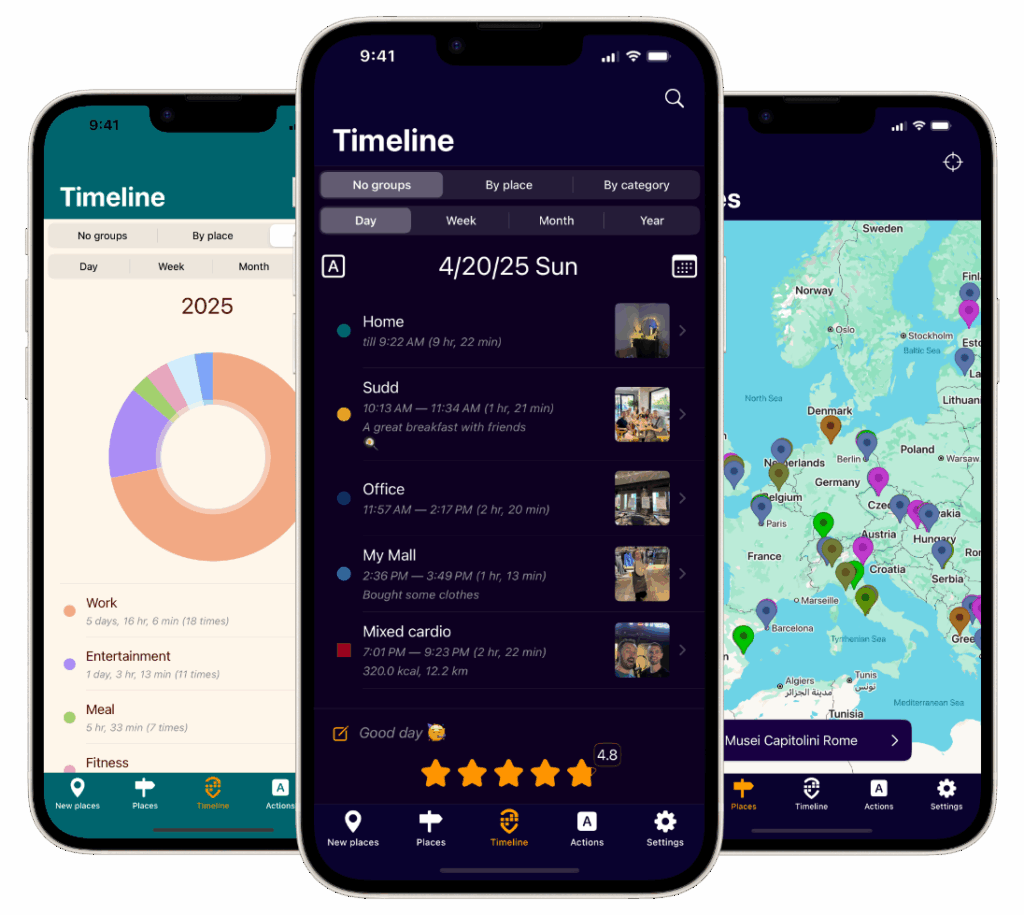
Acti shines in its ability to transform raw location data into a personalized and interactive travel journal. Beyond simply logging locations, you can enhance each entry with photos, comments, and even ratings, adding depth and context to your memories. Imagine revisiting a favorite cafe in Paris, not just seeing the location pinpointed on a map, but also seeing the photo you snapped of your croissant and cappuccino, along with your notes about the charming atmosphere. This feature transforms Acti from a simple travel map app into a powerful memory-keeping tool. Learn more about Acti to understand how it can enhance your travel journaling experience.
Furthermore, Acti offers customizable timeline views. Whether you prefer to review your travels by day, week, month, or year, Acti provides the flexibility to visualize your journeys according to your preference. These views, coupled with detailed summaries categorized by location and type of place (e.g., restaurants, museums, parks), allow you to gain valuable insights into your travel patterns. Discover how much time you spend exploring different types of locations, identify your most frequented destinations, and even spot trends in your travel habits.
Seamless integration with the iOS ecosystem is another key strength of Acti. The app connects with your iOS Calendar and Health apps, including data from your Apple Watch, to paint a more holistic picture of your activities and adventures. Imagine seeing your daily steps tracked alongside the locations you visited, providing a comprehensive overview of your day’s activities. This integration enhances the value of Acti, particularly for users invested in the Apple ecosystem.
Acti caters to a diverse user base, offering multilingual support. Currently available in English, Russian, and Spanish, with German and French in development, Acti aims to reach a global audience. While the current language options cater to a significant portion of travelers, the ongoing development of additional languages signals a commitment to inclusivity and accessibility.
For frequent travelers, privacy-conscious iOS users, travel bloggers, memory journaling enthusiasts, and Apple Watch and Health app users, Acti presents a unique and compelling proposition. It elegantly combines automatic location tracking with personalized journaling features, all within a privacy-focused framework. However, the current limitation to the iOS platform excludes Android users. Furthermore, while the development of German and French language support is promising, their absence might be a temporary drawback for users who rely on these languages.
While pricing information isn’t readily available, the core functionality of automatic location tracking and basic journaling features is likely accessible without a subscription. More advanced features or integrations may potentially be offered through in-app purchases. Regarding technical requirements, Acti is compatible with iOS devices and seamlessly integrates with the Apple Watch and Health app.
Acti’s commitment to privacy, combined with its rich feature set and seamless iOS integration, makes it a standout choice for anyone looking to effortlessly capture and relive their travel experiences. Its automatic logging, personalized journaling features, customizable views, and integrations make it much more than just a travel map app; it’s a powerful tool for transforming your travel memories into a meaningful and engaging narrative.
2. Google Maps
Google Maps is arguably the king of travel map apps and the world’s most widely used mapping service. It offers a comprehensive suite of tools for navigating unfamiliar territories, discovering hidden gems, and managing your journeys with impressive accuracy and detail. From real-time traffic updates that can save you from frustrating delays to extensive local business information that helps you find the perfect restaurant or coffee shop, Google Maps has become an indispensable travel companion for millions. Covering over 220 countries and territories, with features like Street View, satellite imagery, and even indoor maps for major venues like airports and shopping malls, it offers an unparalleled level of coverage and detail. Its particular strength lies in urban navigation, where its dense mapping data and up-to-the-minute information shine. Furthermore, its seamless integration with other Google services, such as search, Gmail, and Google Photos, creates a cohesive and convenient ecosystem for trip planning and documentation.
For frequent travelers and globetrotters, Google Maps offers invaluable peace of mind. Its real-time GPS navigation with turn-by-turn directions provides reliable guidance, whether you’re exploring a bustling city center or navigating a winding countryside road. Live traffic updates and alternative route suggestions help you avoid congestion and arrive at your destination efficiently. The ability to download offline maps for areas with limited or no internet connectivity is a crucial feature for international travel, ensuring you stay on track even in remote locations. Furthermore, the integration with local business information, including reviews and opening hours, allows you to discover hidden gems and plan your itinerary with ease.
Travel bloggers and social media enthusiasts will appreciate the wealth of visual information provided by Google Maps. Street View and 360-degree imagery allow you to virtually explore destinations before you arrive and capture stunning visuals to share with your audience. Integrating Google Maps locations into your posts provides context and enhances the storytelling aspect of your travel content. Moreover, its seamless integration with other Google services facilitates easy sharing of locations and directions with fellow travelers.
Even for the privacy-conscious iOS user, while there are concerns regarding data collection, Google Maps provides customizable privacy settings that allow you to control the information you share. While not a fully private solution, the ability to manage location history and activity data provides some degree of control over your digital footprint.
The app is free to use, requiring no subscription fees, making it accessible to a wide range of users. The technical requirement is simply a device capable of running the Google Maps app, be it Android or iOS, and ideally a stable internet connection for the full functionality. While the app performs adequately offline, leveraging the real-time data requires an internet connection. One of the main drawbacks is the heavy battery usage during navigation, so carrying a portable charger is advisable for extended use.
Compared to other navigation apps like Apple Maps or Waze, Google Maps boasts the most comprehensive and accurate mapping data globally, especially regarding points of interest and business listings. While Waze excels in crowd-sourced real-time traffic information, Google Maps provides a more balanced approach, combining real-time data with historical traffic patterns.
Implementation is straightforward: simply download the app from the App Store or Google Play Store, depending on your device. Upon launching, grant the necessary permissions for location access. To download offline maps, search for the desired area, tap the bottom bar displaying the location name, and select “Download offline map.” Exploring the settings menu allows you to customize various aspects of the app, including navigation preferences and privacy settings.
Despite its drawbacks like battery consumption and privacy concerns, Google Maps remains the gold standard for travel map apps due to its unparalleled global coverage, comprehensive features, and seamless integration with the wider Google ecosystem. It’s a powerful tool for anyone venturing out, be it a seasoned globetrotter or a weekend explorer. The wealth of information, navigational accuracy, and constant updates make it a worthy companion on any journey.
3. Apple Maps
Apple Maps, Apple’s native mapping application, presents a compelling option for travelers deeply embedded in the Apple ecosystem. Designed for seamless integration with iOS and macOS devices, it offers a clean, intuitive interface and a strong emphasis on user privacy. While initially met with some criticism, Apple Maps has significantly evolved, now boasting detailed city experiences, a street-level view feature called Look Around, enhanced navigation capabilities, and increasingly comprehensive data coverage. Making it a viable travel map app contender for frequent flyers and globetrotters.

For the privacy-conscious traveler, Apple Maps stands out with its commitment to anonymized data. Unlike some other travel map apps that collect and utilize extensive user data, Apple Maps minimizes data collection and processes information on-device whenever possible. This focus on privacy makes it a particularly appealing choice for users sensitive to data sharing.
Beyond privacy, Apple Maps excels in its integration with the wider Apple ecosystem. Users can seamlessly access navigation from other Apple apps, share locations with contacts, and even send directions directly to their Apple Watch. This tight integration allows for a streamlined experience, particularly beneficial for users who rely heavily on Apple devices. For instance, if you’re planning a road trip, you can research locations on your Mac, create a collection of saved places, and then access those saved locations instantly on your iPhone while on the road. Siri integration further enhances this seamless experience, allowing users to initiate navigation, search for locations, and receive turn-by-turn directions hands-free.
Apple Maps also offers several features specifically designed for travelers. The Look Around feature provides immersive 360-degree street-level views, allowing users to explore destinations virtually before arriving. This is especially helpful for planning walking routes, finding specific landmarks, and getting a feel for the atmosphere of a place. Flyover mode offers stunning 3D city tours, enabling users to explore major metropolitan areas from a bird’s-eye perspective. Travel bloggers and social media enthusiasts can leverage these features to capture unique perspectives and enhance their content.
Furthermore, Apple Maps integrates smoothly with other travel-related apps and services. For example, you can easily book rides through ride-sharing apps directly from the Apple Maps interface, streamlining the process of getting around in unfamiliar cities. You can also find nearby restaurants, hotels, and attractions, making Apple Maps a comprehensive travel planning tool. Memory journaling and life-logging enthusiasts can benefit from the ability to save locations and attach photos and notes, creating a personalized travelogue.
While Apple Maps offers numerous advantages, it’s essential to acknowledge its limitations. One key drawback is its limited availability outside the Apple ecosystem. Android and Windows users cannot access Apple Maps, making it a less versatile option compared to cross-platform travel map apps like Google Maps. Furthermore, while Apple Maps data coverage has improved significantly, it still lags behind competitors, particularly in rural areas and internationally. Offline functionality is also limited, making it less reliable for travelers venturing into areas with limited or no internet connectivity. Finally, Apple Maps offers fewer third-party integrations compared to some competitors, which may restrict its functionality for users who rely on specific third-party apps for travel planning or navigation.
Despite these limitations, Apple Maps remains a strong choice for frequent travelers, especially those firmly entrenched in the Apple ecosystem. The app is free to use and requires no additional downloads for iOS and macOS users. The clean interface, privacy focus, and seamless integration with Apple devices create a streamlined and user-friendly experience. While it may not be the perfect solution for every traveler, Apple Maps offers a compelling combination of features and benefits, solidifying its place as a prominent travel map app for iOS users. For a deeper dive into its functionalities, visit the official Apple Maps website: https://www.apple.com/maps/
4. Waze
Waze stands out as a dynamic and community-driven travel map app, perfect for navigating the ever-changing landscape of roads and traffic. Unlike traditional navigation apps that rely on static map data, Waze thrives on real-time updates provided by its vast network of users. This crowdsourced information makes it an invaluable tool, particularly for frequent travelers and daily commuters seeking the fastest and most efficient routes. As a powerful travel map app, Waze helps drivers steer clear of traffic jams, road closures, and other hazards, making it a strong contender in the navigation app arena.
Waze’s core strength lies in its real-time traffic avoidance capabilities. Users actively report traffic incidents, speed traps, accidents, and even potholes, creating a constantly evolving map of road conditions. This allows Waze to dynamically adjust routes, guiding you around congested areas and saving valuable time. Imagine you’re a travel blogger heading to a remote location for a photoshoot; Waze can help you navigate unfamiliar roads, bypass unexpected road closures due to local events, and arrive on time, ensuring you don’t miss that perfect golden hour light. Similarly, for daily commuters, Waze can become an indispensable tool for optimizing their daily commute, learning their regular routes and suggesting alternatives based on real-time traffic flow.
Beyond navigation, Waze offers a suite of features designed to enhance the driving experience. Integration with music apps and calendar events allows for seamless transitions between apps, while speed limit displays and speed camera alerts promote safer driving practices. The social aspect of Waze, allowing drivers to see the location of friends also using the app and even chat, can be particularly useful for coordinating meetups or ensuring loved ones arrive safely at their destinations. This feature can be particularly beneficial for frequent travelers coordinating airport pickups or meeting friends at a new restaurant in an unfamiliar city.
Waze is available for free on both iOS and Android platforms, making it accessible to a wide range of users. The app requires a constant internet connection to function optimally due to its reliance on real-time data. While it does offer limited offline map downloads, these are primarily for viewing and do not provide the dynamic routing capabilities that are Waze’s hallmark. This reliance on constant internet connectivity could be a drawback for travelers in areas with poor network coverage or for privacy-conscious users concerned about data usage.
While Waze excels in its real-time traffic updates and community-driven features, it’s important to be aware of its limitations. The app’s eagerness to avoid traffic can sometimes lead to convoluted routes through residential areas, which might not be ideal for all drivers. Furthermore, the interface, while visually engaging, can sometimes be distracting while driving. The gamification aspects, while fun for some, might overwhelm others, particularly in heavy traffic situations. And as mentioned earlier, its dependence on user-generated data means its efficacy can diminish in less populated areas where the user base is smaller. This reliance on user data may also be a concern for privacy-conscious individuals.
Compared to other navigation apps like Google Maps or Apple Maps, Waze prioritizes real-time traffic avoidance and community engagement. Google Maps, while incorporating some real-time traffic data, offers a broader range of features including public transit information and detailed business listings. Apple Maps, on the other hand, emphasizes privacy and integration with the Apple ecosystem. The choice between these apps ultimately depends on individual priorities and needs. If real-time traffic updates and a vibrant community are your primary concerns, Waze is likely the best choice. However, for a more comprehensive mapping experience with offline functionality and broader feature set, Google Maps or Apple Maps might be more suitable.
Setting up Waze is straightforward. Simply download the app, create an account, and you’re ready to navigate. To maximize its effectiveness, ensure your location services are enabled and allow the app to access your calendar and contacts if you wish to utilize the integrated features. For frequent travelers, taking a few minutes to customize notification settings can further enhance the experience.
In conclusion, Waze’s community-driven approach to navigation offers a unique and valuable tool for frequent travelers and daily commuters. Its real-time traffic updates, hazard alerts, and dynamic routing capabilities can significantly improve driving efficiency and safety. While its reliance on user data and potentially distracting interface might be drawbacks for some, its strengths in traffic avoidance and community engagement make it a worthy addition to any traveler’s digital toolkit. Its free availability on both iOS and Android further strengthens its appeal. If you’re looking for a travel map app that can help you outsmart traffic and navigate with the wisdom of the crowd, Waze deserves a place on your smartphone. Check it out at https://www.waze.com.
5. Maps.me
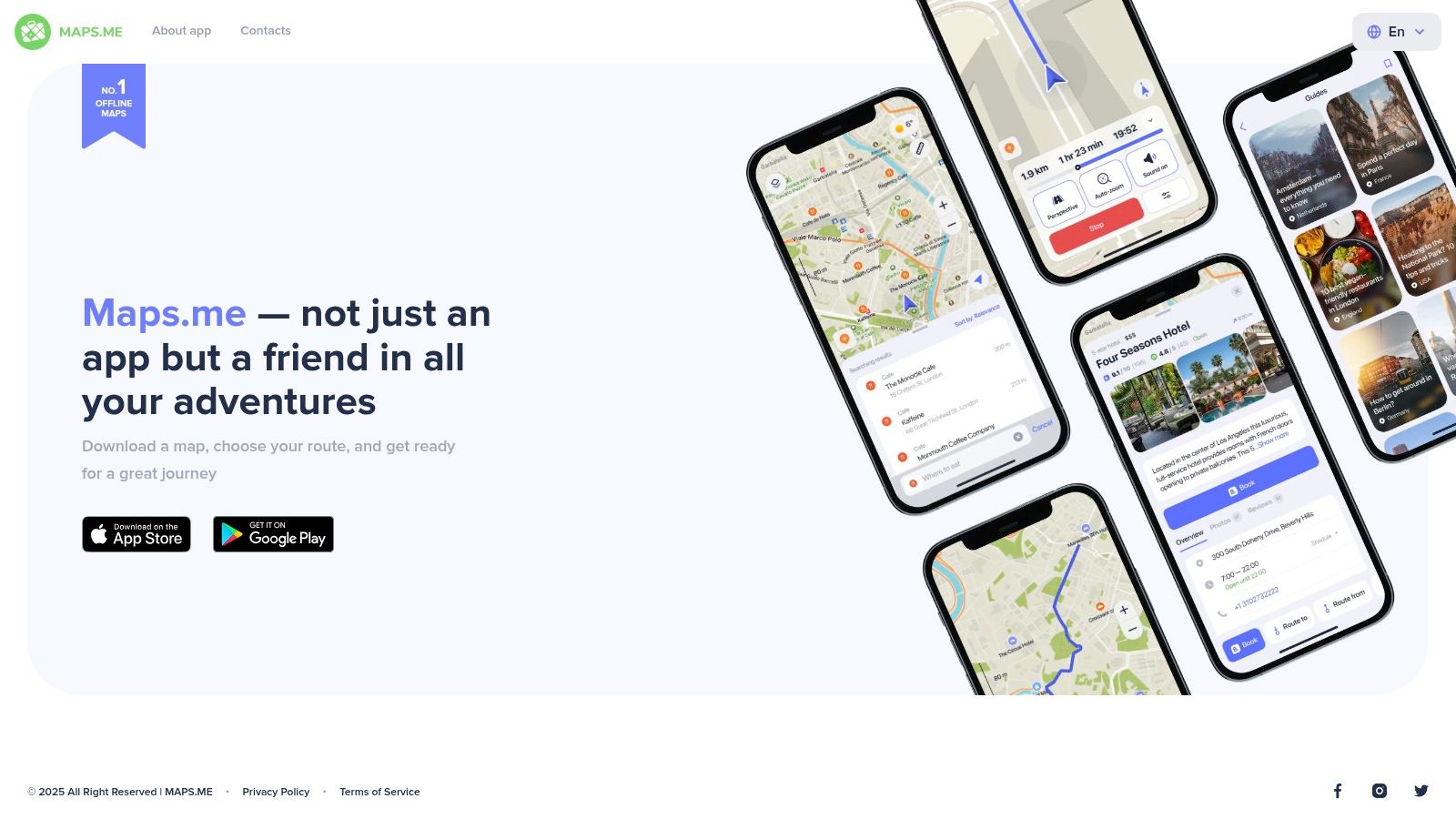
Maps.me stands out as a robust and reliable offline travel map app, earning its place on this list for its comprehensive offline functionality and focus on outdoor exploration. Unlike many navigation apps that require a constant internet connection, Maps.me allows users to download detailed maps of entire countries or regions, enabling seamless navigation even in remote areas or places with limited or expensive data access. This feature is a game-changer for international travelers venturing off the beaten path, particularly those exploring hiking trails, cycling routes, or areas with unreliable cell service. Built on OpenStreetMap data, a collaborative, open-source project, Maps.me provides a rich and frequently updated map resource.
One of the key strengths of Maps.me lies in its detailed information for outdoor enthusiasts. Hikers and cyclists will appreciate the comprehensive trail maps, often including elevation profiles and difficulty ratings. The app also highlights various points of interest, including tourist attractions, restaurants, accommodations, and other essential services, making it a valuable tool for planning and discovering new places. These features combined make Maps.me an excellent choice for privacy-conscious iOS users, ensuring navigation independence without relying on data-hungry online maps. For travel bloggers and social media enthusiasts constantly seeking new adventures, the offline capability and detailed trail information are invaluable for documenting and sharing their explorations, particularly in remote locations.
Maps.me offers a range of practical features for trip planning. Users can bookmark locations, create custom routes, and even measure distances, all without needing an internet connection. This functionality allows for pre-trip preparation and on-the-go adjustments, even when offline. The app also supports multiple languages, catering to international travelers. While its basic navigation interface might not be as polished as some major competitors like Google Maps, its offline capabilities more than compensate for this in areas with limited connectivity. Think of it as a reliable backup for those moments when you’re off-grid and need to find your way. You can even pair your travel journaling with this app – imagine hiking a remote trail, using Maps.me to navigate, and later recording your reflections on the experience. You might find some inspiration at this related article: Learn more about Maps.me.
The core features of Maps.me are free, with optional premium upgrades available for enhanced functionality. While pricing details may vary, the free version provides ample tools for most travelers. However, one should be aware that downloading offline maps can consume significant storage space depending on the region selected, so it’s recommended to manage downloads accordingly. This might be a consideration for memory-conscious users, especially those documenting their travels with photos and videos.
While Maps.me excels in offline navigation, it’s essential to be aware of its limitations. Real-time traffic information is limited due to its offline nature, meaning it’s not ideal for navigating congested urban areas where up-to-the-minute traffic data is crucial. Also, while OpenStreetMap data is frequently updated, it might not be as current as online alternatives in rapidly changing environments. Finally, the large file sizes for offline map downloads, while a testament to their detail, require ample storage space on your device.
Despite these limitations, Maps.me remains a highly valuable travel map app for anyone prioritizing offline accessibility and detailed outdoor information. Its robust features, free core functionality, and comprehensive international coverage make it an essential tool for globetrotters, hikers, cyclists, and anyone looking to explore the world, connected or not. It provides a sense of freedom and security knowing that you have reliable navigation at your fingertips, regardless of internet availability. The website, https://maps.me, offers further information and download links.
6. HERE WeGo: Your Offline Travel Companion
HERE WeGo is a robust and reliable travel map app developed by HERE Technologies, distinguishing itself through comprehensive offline map capabilities and a focus on multi-modal transportation. If you’re a frequent traveler who values detailed navigation information, especially in areas with limited or no internet connectivity, HERE WeGo is a worthy contender among travel map apps. It’s a powerful tool for navigating unfamiliar territories, whether you’re driving across countries, exploring a new city on foot, or relying on public transport. This makes it an excellent choice for globetrotters venturing off the beaten path, privacy-conscious users who prefer not to share their location data constantly, and anyone looking for a dependable navigation solution that doesn’t rely heavily on a constant internet connection.

One of the most compelling features of HERE WeGo is its extensive offline map coverage. With downloadable maps for over 100 countries, you can navigate with confidence even when you’re off the grid. This is incredibly useful for international travel, particularly in areas with unreliable cellular data or when roaming charges are a concern. Imagine exploring the backroads of Italy, hiking through remote trails in Nepal, or navigating a bustling city in Southeast Asia, all without needing a constant internet connection. HERE WeGo provides the peace of mind knowing you won’t get lost, regardless of internet availability.
Beyond offline maps, HERE WeGo excels in providing multi-modal transportation options. Whether you prefer driving, taking public transit, cycling, or walking, the app presents you with various routes and real-time information. Its public transportation integration is particularly noteworthy, offering detailed schedules, platform information, and even real-time updates on delays and disruptions. This is a valuable asset for navigating complex urban transit systems in unfamiliar cities. You can easily compare the time and cost of different transportation modes, empowering you to make informed decisions about how to best reach your destination.
HERE WeGo also provides real-time traffic information and incident alerts, helping you avoid congested routes and plan your journey more efficiently. Voice-guided navigation in multiple languages further enhances the user experience, providing turn-by-turn directions without needing to constantly look at your phone screen. These features make it a valuable tool for road trips and navigating unfamiliar driving routes. While HERE WeGo integrates with some ride-sharing and car-sharing services, this integration is less extensive than what you might find in competitors like Google Maps.
HERE WeGo is free to use without any subscription requirements. This makes it an attractive alternative to other navigation apps that may require in-app purchases or subscriptions for certain features. The app is available on both iOS and Android platforms, ensuring accessibility for a wide range of users.
While HERE WeGo offers a compelling feature set, it’s worth noting some of its limitations. Its interface, while functional, may feel less modern and polished compared to competitors like Google Maps or Apple Maps. It also has a smaller user community, meaning there are fewer user reviews and contributions to local business information. The integration with third-party services is also more limited compared to its more mainstream counterparts.
Despite these drawbacks, HERE WeGo’s strengths lie in its robust offline functionality, accurate map data, and comprehensive multi-modal transportation options. It deserves its place on this list as a reliable and versatile travel map app, especially for those who prioritize offline access and detailed navigation information. If you’re planning an international trip, frequently navigate areas with limited internet access, or simply value a reliable and free navigation app, HERE WeGo is definitely worth considering. You can download the app and explore its features by visiting https://wego.here.com.
7. Sygic GPS Navigation & Maps
Sygic GPS Navigation & Maps secures its spot on this list of top travel map apps thanks to its robust offline functionality, advanced navigation features, and stunning 3D visualizations. While it operates on a freemium model, making some of its best features accessible only through a paid subscription, Sygic offers a compelling alternative to free navigation apps, especially for travelers who prioritize detailed maps, offline access, or specialized driving tools. This travel map app is a strong contender for frequent travelers, globetrotters, and those seeking professional-grade navigation assistance.
One of Sygic’s key strengths lies in its provision of high-quality offline maps sourced from TomTom. This feature proves invaluable for international travel where roaming data charges can be exorbitant or internet connectivity is unreliable. Imagine navigating the winding roads of the Tuscan countryside without worrying about losing signal or racking up data fees. With Sygic, you can download entire regions or countries beforehand, ensuring seamless navigation regardless of internet availability. This offline capability is a boon for privacy-conscious users as well, limiting reliance on real-time data tracking. This makes Sygic a powerful travel map app for those wanting to maintain their privacy.
Beyond basic navigation, Sygic boasts an impressive suite of features. The app’s 3D landmarks and building representations add a layer of realism and visual appeal to the navigation experience, making it easier to orient yourself within unfamiliar cities. Picture effortlessly finding your way through the dense streets of Tokyo, guided by photorealistic representations of iconic landmarks. This immersive experience is a significant advantage over traditional 2D map views. Travel bloggers and social media enthusiasts will also appreciate the visual richness Sygic adds to their journey documentation.
For drivers, Sygic offers specialized tools such as dashcam recording and speed camera warnings. The dashcam function provides an extra layer of security while driving, potentially proving invaluable in case of accidents. Speed camera alerts help drivers stay within legal limits, avoiding costly fines and ensuring a smoother driving experience. These functionalities make Sygic a practical choice for road trips and navigating foreign driving regulations. If you’re planning a cross-country road trip or exploring unfamiliar highways in a rental car, these features can significantly enhance your peace of mind.
Parking assistance is another valuable feature, particularly in congested urban environments. Sygic can help you locate available parking spots nearby, saving you time and frustration. Think about arriving in a new city after a long flight – the last thing you want is to spend hours circling blocks searching for parking. Sygic streamlines this process, making your arrival smoother and less stressful.
Sygic’s advanced lane guidance and junction views are especially useful for navigating complex highway interchanges. The clear visual cues provided by the app reduce the risk of wrong turns, especially in high-stress driving situations. This feature is a significant benefit for professional drivers and anyone navigating unfamiliar road networks.
While Sygic’s advanced features make it a top-tier travel map app, it’s important to consider the associated costs. The premium features, including offline maps, 3D landmarks, dashcam recording, and parking assistance, require a paid subscription ranging from $15 to $30 per year. While the free version offers basic navigation, the full suite of features is locked behind a paywall. Evaluate your individual needs and budget to determine if the subscription cost is justified.
Additionally, the interface can be somewhat complex for casual users, potentially requiring a learning curve. Compared to some free navigation apps, Sygic’s interface is more feature-rich, which can feel overwhelming initially. Take some time to explore the app’s settings and familiarize yourself with its various functionalities before embarking on a trip.
Finally, while Sygic provides real-time traffic data, some users report that it is less comprehensive than what’s offered by free alternatives like Google Maps or Waze. If real-time traffic updates are a critical factor for you, consider comparing Sygic’s performance in your area with other options. The advanced features also contribute to higher battery consumption. Be sure to have a car charger or portable power bank handy, especially during long journeys.
Despite these limitations, Sygic GPS Navigation & Maps remains a powerful travel map app, especially for users who value offline access, detailed mapping data, and advanced navigation tools. Visit the Sygic website (https://www.sygic.com) to learn more and download the app.
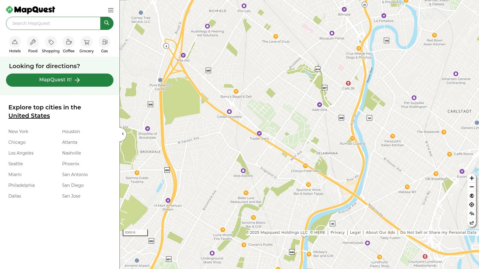
8. MapQuest
MapQuest, a veteran in the digital mapping arena, offers a compelling travel map app for users seeking a balance between simplicity and functionality. While newer apps may boast flashier features, MapQuest retains its appeal with its straightforward interface and focus on core navigation tools. It’s a reliable choice, especially for users within North America, offering turn-by-turn navigation, real-time traffic updates, and local search capabilities. This makes it a worthwhile contender in the crowded field of travel map apps. Whether you’re planning a cross-country road trip or navigating a new city, MapQuest provides the essential tools to get you there. It’s a particularly valuable resource for finding affordable fuel, thanks to its integrated gas price comparison tool.
One of MapQuest’s standout features is its gas price comparison tool. In an era of fluctuating fuel costs, this feature empowers users to make informed decisions about where to fill up, potentially saving money on long journeys. Imagine you’re on a road trip and nearing empty; a quick search on MapQuest reveals nearby gas stations and their current prices, allowing you to choose the most economical option. This practical feature can significantly impact travel budgets, especially for frequent drivers. Beyond navigation, MapQuest integrates roadside assistance, providing peace of mind in case of unexpected breakdowns. Knowing help is just a tap away can alleviate stress and ensure a smoother travel experience.
MapQuest also shines with its route optimization for multiple stops, a crucial feature for travelers with complex itineraries. Whether you’re planning a sightseeing tour with multiple attractions or running errands across town, MapQuest can efficiently plot the best route, minimizing travel time and maximizing efficiency. This feature is particularly helpful for delivery drivers or anyone managing a busy schedule on the go. Additionally, the app provides local business search and information, allowing you to quickly find restaurants, hotels, and other essential services along your route. Imagine you’re in a new city and craving a specific type of cuisine; MapQuest can help you locate nearby options and even provide reviews and contact information.
While MapQuest excels in its core functionality and ease of use, it’s important to acknowledge its limitations. Compared to some newer travel map apps, MapQuest’s international coverage is less extensive. While it provides robust coverage in North America, users traveling abroad might find its data less comprehensive. Also, MapQuest offers fewer advanced features compared to some modern alternatives. Features like offline maps and augmented reality navigation are either basic or absent. If you frequently travel internationally or require highly specialized mapping features, you might consider exploring other options. You can Learn more about MapQuest and its potential integration with travel journaling tools for a more comprehensive approach to documenting your adventures.
Furthermore, the frequency of map updates is less frequent compared to some competitors. This can occasionally lead to outdated information, particularly in rapidly developing areas. However, for most general navigation purposes, MapQuest’s data remains reliable. The app is free to use and supported by minimal, non-intrusive advertising. This makes it an accessible and cost-effective option for budget-conscious travelers. Setting up and using MapQuest is incredibly straightforward. Simply download the app from your respective app store, grant the necessary permissions, and you’re ready to start navigating. The user interface is intuitive and easy to navigate, even for first-time users. For those who value a simple, reliable, and cost-effective travel map app, especially within North America, MapQuest is a worthy choice. Its focus on core navigation features, coupled with helpful additions like gas price comparison and roadside assistance, makes it a valuable tool for frequent travelers and everyday commuters alike.
Travel Map Apps Feature Comparison
| App | Core Features/Characteristics | User Experience & Quality ★ | Value & Price 💰 | Target Audience 👥 | Unique Selling Points ✨ |
|---|---|---|---|---|---|
| 🏆 Acti | Automatic visit logging, photo/comments/ratings, iOS integration | ★★★★☆ Privacy-focused, intuitive timeline views | 💰 Free, no registration/cloud | 👥 Privacy-conscious travelers, bloggers | ✨ On-device data, iOS Calendar & Health sync |
| Google Maps | Real-time GPS, traffic, offline maps, business info | ★★★★★ Most accurate global data | 💰 Free | 👥 All users, commuters, tourists | ✨ Street View, live traffic updates |
| Apple Maps | Navigation, Look Around imagery, Siri integration | ★★★★☆ Clean design, strong privacy | 💰 Free | 👥 iOS/macOS users | ✨ Privacy-focused, Flyover 3D tours |
| Waze | Community-driven traffic, social features | ★★★★☆ Real-time traffic, engaging interface | 💰 Free | 👥 Daily commuters, social drivers | ✨ User reports, gamification |
| Maps.me | Offline maps, hiking/cycling routes, multi-language | ★★★☆☆ Strong offline use, less updated data | 💰 Free core, premium optional | 👥 Travelers in low-connectivity areas | ✨ Complete offline maps |
| HERE WeGo | Offline maps, multi-modal transport, ride-share | ★★★★☆ Solid offline & public transit info | 💰 Free | 👥 Urban and rural travelers | ✨ Multi-modal navigation |
| Sygic GPS Navigation | TomTom offline maps, 3D landmarks, dashcam | ★★★★☆ Premium features, complex UI | 💰 Freemium ($15-30/yr) | 👥 Professional drivers, advanced users | ✨ 3D landmarks, dashcam, advanced guidance |
| MapQuest | Turn-by-turn, gas prices, roadside assistance | ★★★☆☆ Simple UI, North America focus | 💰 Free with ads | 👥 North American drivers | ✨ Gas price comparisons, roadside integration |
Ready to Explore?
Choosing the right travel map app can significantly enhance your travel experiences. From offline navigation with apps like Maps.me and HERE WeGo, to real-time traffic updates with Waze, to the familiar interfaces of Google Maps and Apple Maps, there’s a travel map app tailored to every globetrotter’s needs. Remember to consider factors like offline functionality, real-time traffic data, points of interest, privacy features, and integration with other apps when making your decision. For privacy-conscious iOS users, Apple Maps offers a strong balance of features and data protection. Travel bloggers and social media enthusiasts might find the robust features of Google Maps or Sygic particularly useful. And for those focused on memory journaling and life-logging, integrating your chosen travel map app with your Apple Watch and Health app can add another dimension to your travel records.
Whether you’re a frequent traveler navigating unfamiliar cities, a memory-making enthusiast documenting your journeys, or simply someone looking for a reliable way to get from point A to point B, the perfect travel map app is out there. Finding the right travel map app empowers you to explore with confidence, discover hidden gems, and create unforgettable memories.
Want to take your travel journaling to the next level? Acti automatically maps your journeys, allowing you to seamlessly visualize your adventures while maintaining your privacy. Start documenting your travels effortlessly with Acti!
Leave a Reply